R.C. Maher 1/10/2003
NOTE: this is an informal description of my experience, not an authoritative document. Do not rely on this information, as trail conditions, wildlife activity, and acceptable use rules are subject to change at any time. Use your own judgment and common sense, hike safely, and always follow leave no trace principles.
Mount Baldy is on the high ridge of the Bridger Range rising to the northeast of Bozeman. Although the USGS Saddle Peak Topographic map indicates "Baldy Mountain" as the high point on the ridge (8914'), most local lore treats Baldy as the southern rounded "bald bump" on the ridge, so that's where we decided to go.
The two most popular routes to Mount Baldy seem to be the south ridge route starting at the 'M' Trail on Bridger Canyon Road, and the southwest ridge route starting at the Sypes Canyon trailhead. Instead, we chose to try a shorter but undefined approach from the west, starting at the Middle Cottonwood Creek trailhead.
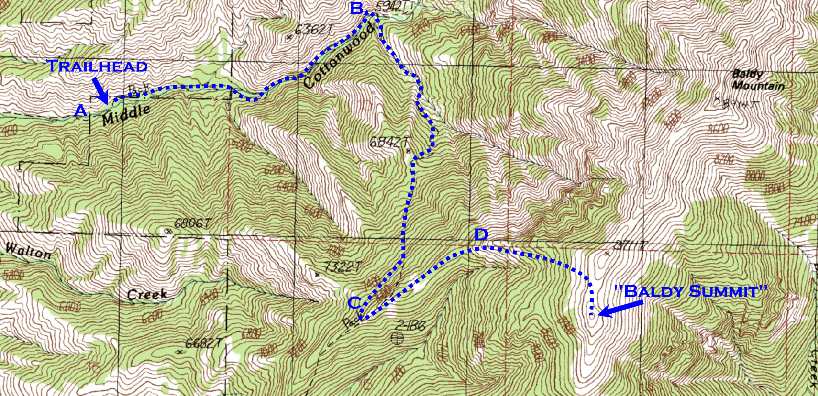
Accompanied by David Dickensheets, Phil Himmer, and Todd Kaiser (all of the ECE Department, MSU), we drove north on 19th Street across I-90, then continued north onto Springhill Road for about 3.5 more miles to Toohey Road, where there is a sign for Middle Cottonwood Creek. We turned right (east) on Toohey, turned right at the tee and followed around onto Saddle Mountain Road, and continued to the Middle Cottonwood Creek trailhead (about 5440'), labeled 'A' on the map below. There are no facilities at the trailhead. The first part of the route crosses private property, so hikers are advised to stay on the marked trail (click map to see a larger version, 3MB).
The trail follows Middle Cottonwood Creek for about a mile to a signed trail junction (elev. 5960') at the Bridger National Recreation Trail (label 'B'). We proceeded south (right) on the trail up the canyon for about a mile until we reached the vicinity of the ridge at the head of Walton Creek (label 'C'). Note that there is some evidence that the location of the trail marked on the USGS topo map is a bit too far east at this point. In any case, the ridge (just below the 'C' on the map above) separates Sypes Canyon (off the map to the south) from the Walton Creek drainage. We left the main trail and bushwhacked steeply east up the wooded slope to reach the rocky ridgeline. The snow was only about a foot deep, and provided reasonably good footing up to the ridge. The views in all directions from the ridge were very enjoyable, and the remainder of the route curving up to the summit area was visible.
We then followed the crest of the ridge up to the north east. We skirted some rocky outcroppings by traversing to the right (south) side of the ridge line at a couple points (label 'D'). As the ridge broadened and curved to the east, we bushwhacked through knee-deep snow among the trees and followed a steeply ascending trajectory up toward the saddle between Baldy and its slightly taller companion bump to the north. The last quarter mile was above the trees and quite windy, but the views were tremendous. Due to the lack of snow, we all had trouble believing it was the middle of January in Montana!
We descended via the same route. One way distance was about 3 miles, with an elevation gain of 3474'. We started at 9:48AM and returned to the trailhead before 4:00PM, including a few rest stops and about 30 minutes for a lunch break.
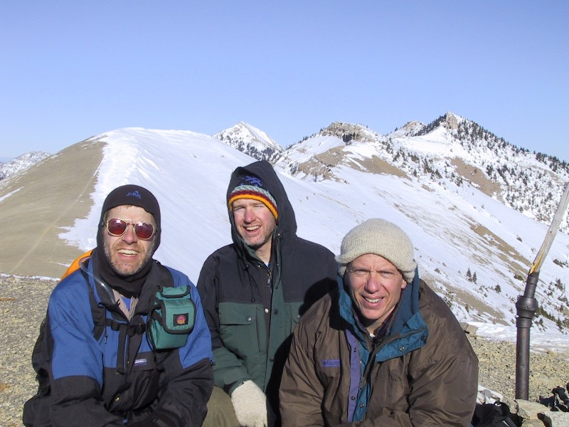
Here is a photo taken by Phil Himmer of (L-R) me (Rob Maher), David Dickensheets, and Todd Kaiser on the Baldy summit. The view to the north (behind us) includes Saddle Peak (above David's head).