
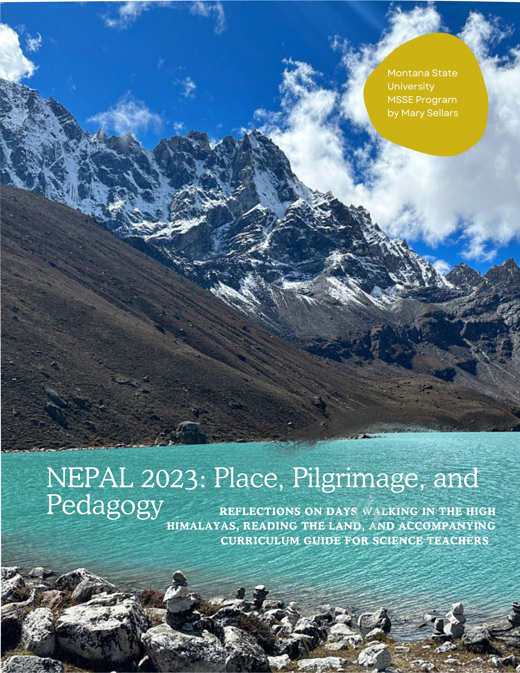
Nepal Instructional Resources
Table of Contents
Mary Sellars
Kim Busch
-
Reflection
-
STEM Learning Opportunities in the Himalayas
-
Lesson Plan 1: The Formation of the Himalayas
-
Lesson Plan 2: Analyzing the Impact of Tectonics
-
Lesson Plan 3: Analyze Fossil Evidence
-
Lesson Plan 4: Factors Affecting Climate in the Himalayas
Victor Lorenz
-
Reflection
-
Lesson Plan 1: Consequences of Climate Change
-
Lesson Plan 2: Analyzing Plate Tectonic Forces in the Formation of the Himalayan Mountain Range
-
Lesson Plan 3: Analyzing the Implications of Glacial Runoff in the Himalayan Mountains for Hydroelectric Production
-
Lesson Plan 4: Analyzing the Socio-cultural Consequences of Tourism in the Himalayas on the Sherpa Community
-
Embarking on a Geological Exploration: Nepal Evening Geology Talk
Kaitlin Murphy
Donna Tully
Greg Anderson
Jessica Chute
-
Reflection
-
Lesson Plan 1: Blood Oxygen Concentration Variance by Elevation
-
Lesson Plan 2: Boiling Time of Water at Different Elevations
Mary Sellars: Nepal Curriulum Guide and Handbook
Kim Busch: Reflection
The Nepal School System
I am not sure what I expected from schools in Nepal, but it wasn’t really what we saw. The elementary school seemed very “British”. The students wore uniforms and sat at wooden desks organized in rows, much different from modern American early childhood classrooms.
American early childhood teachers create cozy, “cute” learning spaces with round tables, small chairs, and a large area, usually carpeted or with a large rug, for whole-group instruction. Most have numerous areas set up for small group instruction and center work. They usually have classroom libraries full of books for students to use. The walls are covered with learning posters and student art. I did not notice those types of items in the classroom we visited.
But what I did notice was that the Nepalese early childhood classrooms had teacher-made handwritten labels for many everyday items. All the labels were in English. Students in Nepal start learning English in first grade. The Nepalese people value speaking English as well as Sherpa and Nepalese.
In the United States, we have used the school system to remove language from entire groups of people. Even after we stopped putting Native students in boarding schools and punishing them for speaking their native language, we continued to discourage families from speaking two languages. Many Speech teachers blamed speech problems on the family because they spoke a different language at home. It wasn’t until recently that Americans started valuing the ability to be able to speak more than one language.
The older students' classrooms seem to be very basic. I don’t actually remember if there were learning posters or decorations, Again, most of the instruction seemed to be in English. Some students were more comfortable speaking English and talking in front of a group of people.
Surprisingly, the primary school near Lukla had a large computer lab. There were at least 30 Dell desktop computers. All these donated machines were packed in by humans or animals. All those monitors and CPUs would draw a lot of electricity. It is a challenge for the school to generate enough electricity to operate the lab. It is obvious that the community values their students developing computer skills. It would be nice if they could use laptops or Chromebooks, but what are they going to do with all the electronic equipment when it is out of date?
Students were working with a textbook on how to use the Windows operating system. In my school, the only students who get basic computer skill instruction are 6th graders who do not take Band, Orchestra, or Choir. So, out of 230 students, about 30 of them get this instruction during the second semester.
I assume that the school near Lukla has internet service, but I don't know at what level or if the students can access it. I would guess it is limited since we weren’t always able to access Wifi, and it was unreliable. I do not know if that is a pro or a con.
My students and I are heavily dependent on internet access, to the point that I will use the hotspot on my phone if I lose connectivity. My students demonstrate addictive behaviors in regard to any type of game. I think we, Americans, have lost a connection to each other and the natural world because of our reliance on the internet.
During a class visit, we asked one of the older students about what he would like to do after high school. He expressed that he would like to come to the United States. I forgot what a fantastic country we live in and that people view it as a place with tremendous opportunities for a better life. It is easy to be disillusioned by current political issues and public opinion of the educational system.
Another significant difference between the school systems in America and Nepal is parent and community expectations. Nepalese parents expect the school to provide basic academic instruction. Many American parents or society expect their children to receive much more. For many students, the school system provides two meals, social and emotional support, and mental health services, on top of academics.
Both, the American and Nepalese school systems, have some form of academic testing. My research suggests students take a Secondary Education Examination (SEE) at the end of grade 10. The exam includes English, Nepali, mathematics, science, social studies, and optional subjects based on the students' selected path of study. From there, they often have to leave their homes to pursue higher education in Kathmandu.
In the United States, we begin standardized testing as early as 3rd grade. A great deal of pressure is placed on elementary school teachers to have students test at proficient or advanced levels. Students may receive remediation courses based on their scores. In my district, at the middle school level, students begin to be placed in leveled math and English classes based on those scores. Advanced students then have access to enriched or higher-level courses, but struggling students often have to take remedial classes instead of electives.
Class sizes were notably smaller in the Nepalese schools we visited. The rooms we visited had about 10 to 12 students. These schools seemed to have a lot of students, so I am assuming it was a school decision to have smaller class sizes. I was unable to find any information about government-mandated class sizes in Nepalese schools. It is more likely that class size depends on location, infrastructure, and population. In Montana, Kindergarten, first and second grade should be 20 or fewer, but jump to 28 for 3rd and 4th grade. Fifth grade and up can have up to 32 students. Of course, in our rural areas, classes would be significantly smaller because of population density.
In conclusion, the Nepalese schools were very traditional but also very valued. I wish we as Americans would realize how lucky we are to have neighborhood schools with highly qualified teachers.
Kim Busch: STEM Learning Opportunities in the Himalayas
With the help of ChatGPT 3.5, I explored the Science, Technology, Engineering, and Math (STEM) learning opportunities related to the Himalayan mountains and found there to be significantly more than I first realized. ChatGPT suggested that “integrating the study of the Himalayan ecosystems into STEM education provides an opportunity for students to understand the interconnectedness of environmental, geological, and human systems, fostering a holistic approach to scientific inquiry and problem-solving.” I agree and would add that would integrates well with Social Studies as well. Using the AI suggestions, I researched the topics and aligned them with the Next Generation Science Standards for Middle School and Middle School Social Studies Standards.
The Himalayas' location and geology create a unique and diverse ecosystem. The Himalayas are some of the youngest mountains in the world. They were created by the collision of the Indian and Eurasian tectonic plates. The collision between the Indian Plate and the Eurasian Plate has led to the dramatic upliftment of the Himalayan region. The Himalayas are still rising today at a relatively slow rate. The uplift is not uniform, and different segments of the mountain range are rising at different rates. This ongoing convergence results in significant seismic activity in the region. Earthquakes are common, and the Himalayan region is known for its seismic hazards.
The Himalayas cover about 1500 miles (2400 km) at approximately 28 degrees North of the equator, the same latitude as the southern United States. The area ranges from tropical to perennial snow and ice, depending on the elevation. The outer edge of the Himalayan range (1,650 ft. to 3,300 ft.) includes tropical and subtropical broadleaf forests and a number of threatened species, including the Asian elephants. Middle elevations (6,600 ft. to 9,800ft.) of the eastern region have temperate broadleaf and mixed forest. These forests can receive up to 80 inches of precipitation. The wide range of wildlife includes numerous types of birds and the golden langur monkeys. In the northeastern Himalayas (8,200 to 13,000 ft.), there is a temperate sub-alpine conifer forest with red pandas, takin, and mush deer. The alpine shrubs and grassland make up the area from 9,850 to 16,400 feet. This area has mild summers and cold winters. It is also the home to the snow leopard, Himalayan tahr, musk deer, and pikas. The complex topography of the region has led to the evolution of numerous specifics that are not found anywhere else in the world. The snow line occurs at about 16,000 feet, creating harsh conditions with little to no vegetation.
The Himalayan mountain range plays a crucial role in influencing the weather and climate of the surrounding region. During the winter months, the Himalayas act as a barrier to the movement of cold air masses from the north. This barrier prevents the cold, dry air from entering the Indian subcontinent. During the summer, the intense heating of the Indian subcontinent draws moist air from the Indian Ocean. As this moist air rises, it encounters the Himalayas, causing it to cool and release heavy rainfall on the windward side of the mountains.
The Himalayas are home to the world's third-largest deposit of snow and ice, including approximately 15,000 glaciers. During the warmer months, glacier melting contributes to water flow into major river systems, including the Ganges, Brahmaputra, and Indus. These rivers play a vital role in supporting agriculture and ecosystems in the surrounding plains.
The Himalayas play a role in global atmospheric circulation. The interaction between the atmosphere and the high mountain range contributes to the dynamics of the Asian monsoon system, which, in turn, influences global weather patterns.
Lesson Topics: Mountain Geology and Ecosystems
- Students will discover how the geological processes shape the landscape. (MS-ESS2-2)
- Students will examine the geological features of the Himalayas and their influence on the diversity of ecosystems. (MS-LS2-2)
- Students will discuss how geological processes shape the landscape and affect the distribution of flora and fauna. (MS-LS2-1)
- Students will learn about flora and fauna's adaptations to the Himalayas' high-altitude environment. (MS-LS2-2)
- Students will learn about the monsoon season in the Himalayan region and how it influences weather patterns. (MS-ESS3-6)
Lesson Topic: Natural Hazards and Disaster Resilience:
- Students will examine the natural hazards caused by the tectonic movement that affect the Himalayan region, such as earthquakes, landslides, and avalanches. (MS-ESS2-2)
- Students will review and develop strategies for building resilience in ecosystems and human communities in the face of these hazards. (MS-LS2-5, MS-ESS3-2, SS.G.6-8.4, 8.5, 8.6)
Lesson Topic: Himalayan Forests and Wildlife Conservation:
- Students will study the forests of the Himalayas and their importance for wildlife habitat. (MS-LS2-2, MS-LS2-3, MS-LS2-4)
- Students will explore conservation initiatives aimed at protecting endangered species, like the snow leopard and red panda. (MS-LS2-5)
Lesson Topic: Biodiversity in the Himalayan Region:
- Students will explore the rich biodiversity of the Himalayan ecosystems, including the variety of flora and fauna that inhabit different altitudes.(MS-LS2-1)
- Students will research and discuss the role of the Himalayas as a biodiversity hotspot and the importance of conservation efforts.(MS-LS2-4)
- Students will understand the diverse climate zones in the Himalayas and explore how elevation influences temperature and precipitation. (MS-ESS2-5, MS-ESS2-6)
Lesson Topic: Climate Change Impact on Himalayan Ecosystems:
- Students will research the effects of climate change on the Himalayan region, such as changes in temperature, glacial retreat, and altered precipitation patterns.(MS-ESS3-5, MS-ESS2-6)
- Students will use research to predict the implications for ecosystems, including potential shifts in vegetation zones and impacts on wildlife.(MS-LS2-4, MS-ESS3-5)
Lesson Topic: Traditional Ecological Knowledge of Himalayan Communities
- Students will research the traditional ecological knowledge of indigenous communities living in the Himalayan region and compare it to the indigenous knowledge of other regions. (SS-G.6-8.1, 8.2, 8.3, 8.4, 8.5, 8.6)
- Students will research and discuss how local communities adapt to and sustainably manage the unique ecosystems of the mountains.(MS-ESS3-5)
- Students will investigate the cultural and spiritual significance of the Himalayas in local communities. (SS-G.6-8.1, 8.2, 8.3, 8.4, 8.5, 8.6)
- Students will explore how these values contribute to conservation efforts and sustainable practices. (MS-ESS3-5)
Lesson Topic: River Systems and Watersheds:
- Students will study the major river systems originating from the Himalayas, such as the Ganges, Indus, and Brahmaputra. (MS-ESS2-4)
- Students will explore the importance of these rivers in sustaining ecosystems downstream and the challenges they face due to human activities.(MS-ESS3-3, SS-G.6-8.1, 8.2, 8.3, 8.4, 8.5, 8.6)
Lesson Topic: Glacial Melt and Water Resources
- Students will investigate the impact of glacial melt on water resources in the Himalayan region. ((MS-LS2-3, MS-ESS3-3)
- Students will research the role of glaciers in providing freshwater and the potential consequences of glacial retreat on downstream ecosystems and human communities. (MS-LS2-3, MS-ESS3-3, SS-G.6-8.1, 8.2, 8.3, 8.4, 8.5, 8.6).
References
fultonk. (2011a, February 11). The Himalayas ~ Himalayas Facts | Nature | PBS. Nature. https://www.pbs.org/wnet/nature/the-himalayas-himalayas-facts/6341/
fultonk. (2011b, February 11). The Himalayas ~ Tectonic Motion: Making the Himalayas | Nature | PBS. Nature. https://www.pbs.org/wnet/nature/the-himalayas-tectonic-motion-making-the-himalayas/6342/
Hatch, R. (2015, February 9). The Weather and Climate of the Himalayas. HimalayanWonders.com. https://www.himalayanwonders.com/blog/weather-climate-himalayas.html
Himalayas. (2023). Britannica Kids. https://kids.britannica.com/students/article/Himalayas/274884
MONTANA CONTENT STANDARDS FOR SOCIAL STUDIES FOR K-12. (n.d.). Retrieved December 3, 2023, from https://opi.mt.gov/LinkClick.aspx?fileticket=z2KzgjyQYtY%3D&portalid=182
MS-ESS2 Earth’s Systems | Next Generation Science Standards. (2023). Nextgenscience.org. https://www.nextgenscience.org/dci-arrangement/ms-ess2-earths-systems
MS-ESS3 Earth and Human Activity | Next Generation Science Standards. (2023). Nextgenscience.org. https://www.nextgenscience.org/dci-arrangement/ms-ess3-earth-and-human-activity
MS-LS2 Ecosystems: Interactions, Energy, and Dynamics | Next Generation Science Standards. (2023). Nextgenscience.org. https://www.nextgenscience.org/dci-arrangement/ms-ls2-ecosystems-interactions-energy-and-dynamics
Kim Busch: Lesson Plan 1
Title: The Formation of the Himalayas: Exploring Plate Tectonics
Lesson Outline generated with Eudaide.ai and modified and enhanced by Kim Busch
Grade Level: Middle School (Students Grade 6-8)
Time: 45-52 minutes
Objective: Students will explain the primary geological process responsible for the movement of the Indian Plate towards the Eurasian Plate, leading to the formation of the Himalayas.
Key Vocabulary:
- Plate tectonics
- Continental drift
- Convergent boundary
- Subduction
- Collision
- Fold mountains
Materials:
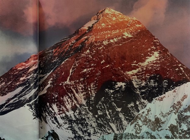
* Images of Mt. Everest
* World map or globe
* Large paper or whiteboard
* Markers
* Handouts with diagrams of plate boundaries
* Internet access or other resources (YouTube resources, articles from National Geographic) about the formation of the Himalayas
Procedure:
Engage (5 minutes):
- Begin the lesson by showing an image of Mt. Everest.
- Ask the students if they have ever wondered how mountains like the Himalayas were formed.
- Facilitate a brief discussion to generate curiosity and activate prior knowledge about plate tectonics.
Explore (10 minutes):
- Divide the class into groups of 3-4 students.
- Distribute handouts with diagrams of plate boundaries.
- Instruct each group to examine the diagrams and discuss the different types of plate boundaries.
- Encourage students to identify the type of boundary that exists between the Indian Plate and the Eurasian Plate.
Explain (10 minutes):
- Bring the class back together and ask each group to share their findings.
- Discuss the concept of convergent plate boundaries and explain how they are responsible for the formation of mountains.
- Provide a brief overview of the movement of the Indian Plate towards the Eurasian Plate and the geological processes involved.
- Have students watch an introductory video about plate tectonics (Paul Anderson's Bozeman Science Video)
- Facilitate a class discussion to ensure understanding and address any questions.
Elaborate (15 minutes):
- Divide the class into pairs and provide each pair with internet access and a variety of predetermined links.
- Instruct students to conduct research on the geological processes involved in the formation of the Himalayas.
- Encourage students to take notes and gather information to support their understanding of the topic.
- Circulate the classroom to provide assistance and monitor student progress.
Evaluate (10 minutes):
- Ask each pair of students to prepare a short presentation summarizing their research findings.
- Provide time for the presentations and encourage questions and discussions.
- Assess student understanding throughout the presentations and provide feedback.
Closure (2-5 minutes):
- Summarize the key points discussed during the lesson.
- Emphasize the primary geological process responsible for the movement of the Indian Plate towards the Eurasian Plate, leading to the formation of the Himalayas.
- Encourage students to reflect on their learning and ask any remaining questions.
Options for Differentiation:
- For students who need additional support, provide simplified diagrams and explanations.
- For advanced students, encourage them to explore additional geological processes involved in mountain formation beyond the Himalayas.
- Provide English language learners with visual aids and vocabulary support. (Informational text reading levels differentiated by Differ.)
Assessment of Learning:
- Observe student participation and engagement during discussions and group work.
- Assess student understanding through their contributions to the class discussion.
- Evaluate the quality of the presentation and the accuracy of information shared by each pair of students.
Kim Busch: Lesson Plan 2
Title: Analyzing the Impact of Tectonic Movement on Natural Hazards in the Himalayan Region
Grade: Middle School (Students Grade 6-8)
Lesson Outline generated with Eudaide.ai and modified and enhanced by Kim Busch
Duration: 45-52 minutes
Objective: Students will analyze the geological phenomenon of tectonic movement in the Himalayan region, focusing on its impact on natural hazards, including earthquakes, landslides, and avalanches.
Materials:
- Interactive whiteboard or projector
-Video of earthquake activity in Nepal
- Laptops or tablets with internet access
- Geological maps of the Himalayan region
- Images and videos depicting tectonic movement and natural hazards
- Chart paper and markers
Key Vocabulary:
- Tectonic movement
- Geology
- Himalayan region
- Plate boundaries
- Earthquakes
- Landslides
- Avalanches
- Natural hazards
- Seismic activity
- Epicenter
Background knowledge:
Prior to this lesson, students will have completed lessons about plate tectonics and the specific interactions between the Indian and Eurasian plates that created the Himalayan mountains. The ongoing tectonic activity results in current events, including earthquakes, landslides, and avalanches.
Procedure:
Engage (10-12 minutes):
- Begin the lesson with a short video about the 2015 Earthquake in Nepal.
- Ask students to share their initial thoughts and observations about why this happened.
Explore (10-12 minutes):
- Have students use their devices in pairs or small groups to watch different videos explaining earthquakes.
- Students then write their definitions of earthquakes.
- Each group presents their definition.
Explain (10-12 minutes):
- Using the interactive whiteboard or projector, present a geological map of the Himalayan region.
- Explain the concept of plate boundaries and how they relate to tectonic movement.
- Discuss how tectonic movement in the Himalayan region leads to natural hazards such as earthquakes, landslides, and avalanches.
- Show images and videos of these natural hazards occurring in the region to provide visual context.
- Facilitate a class discussion, allowing students to ask questions and share their observations.
Elaborate (10-12 minutes):
- Divide students into small groups and provide each group with a large sheet of chart paper and markers.
- Assign each group one natural hazard (earthquakes, landslides, or avalanches) to focus on.
- In their groups, students should brainstorm and list the causes, effects, and preventive measures related to their assigned natural hazard.
- Encourage students to collaborate and think critically about the information they have learned.
Evaluate (5-7 minutes):
- Have each group present their findings to the class.
- Encourage the class to actively listen and take notes on the other groups' presentations.
- Conclude the lesson with a closure activity where students summarize their learning by answering the following questions:
- What is tectonic movement and how does it impact the Himalayan region?
- What are some natural hazards caused by tectonic movement?
- How can people mitigate the impact of these natural hazards?
Options for Differentiation:
- Provide additional resources or simplified readings for struggling students.
- Pair students with different abilities during the Explore and Elaborate stages to facilitate peer learning.
- Offer extension activities for advanced students, such as researching other regions with significant tectonic movement and comparing their natural hazards.
Kim Busch: Lesson Plan 3
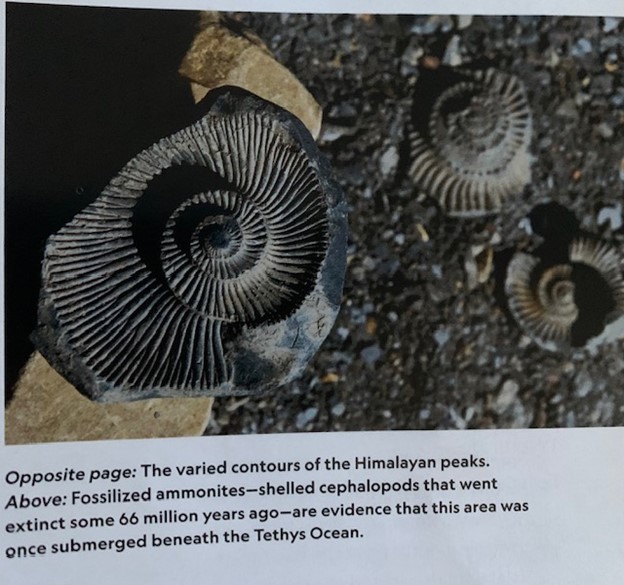
Title: Analyze fossil evidence found on Mt. Everest
Lesson generated with Eudaide.ai and modified/enhanced by Kim Busch
Grade Level: Middle School (Students Grade 6-8)
Duration: 45-52 minutes
Key Vocabulary:
- Fossil
- Geological history
- Ecosystem
- Adaptation
- Sedimentary rock
- Fossilization process
- Paleontologist
- Extinct
- Species
- Stratigraphy
Materials:
-Weather Channel Image and article: Why Are There Fish Fossils High Up in the Himalayas
-fossil replicas (or images)
-hand lens
Lesson Outline:
Engage (5-7 minutes):
- Begin the lesson by asking students if they know what fossils are and how they are formed.
- Show images of fossils found on Mt. Everest to generate curiosity and capture students' attention.
- Engage students in a brief class discussion about what they think the fossils found on Mt. Everest can tell us about the region's geological history and ancient ecosystems.
Explore (10-12 minutes):
- Divide students into small groups and provide each group with a set of fossil replicas, magnifying glasses, and hand lenses.
- Instruct students to closely observe and analyze the fossil replicas, discussing their observations within their groups.
- Encourage students to make connections between the fossils and what they already know about ancient life forms and geology.
Explain (10-12 minutes):
- Facilitate a whole-class discussion to share and compare the observations made by different groups.
- Introduce key vocabulary terms related to fossils and geological history.
- Explain the process of fossilization and how fossils can provide clues about ancient ecosystems and species that existed in the past.
- Use visual aids, such as diagrams or charts, to support student understanding.
Elaborate (10-12 minutes):
- Provide students with a reading passage or article about the fossil evidence found on Mt. Everest.
- Instruct students to read the passage individually or in pairs and identify key information related to the region's geological history and ancient ecosystems.
- Encourage students to annotate the text, highlight important details, and write down any questions they have.
Evaluate (5-7 minutes):
- Assess student understanding by conducting a short quiz or exit ticket that includes multiple-choice or short-answer questions about the lesson's content and key vocabulary.
- Alternatively, students can create a concept map or a visual representation of the connections between fossils, geological history, and ancient ecosystems.
- Use the assessment to guide future instruction and provide feedback to students.
Closure:
- Conclude the lesson with a brief class discussion, allowing students to share their key takeaways from the lesson.
- Summarize the main points of the lesson, emphasizing the importance of analyzing fossil evidence to understand the geological history and ancient ecosystems of a region.
Differentiation Options:
- Provide additional visuals, such as videos or interactive simulations, for students who may struggle with understanding the concept of fossilization.
- Offer advanced reading materials or research projects for students who demonstrate a deeper understanding of the topic.
- Pair students with different abilities together during the exploration and elaboration phases to foster collaboration and peer learning.
Assessment of Learning:
- Quiz or exit ticket assessing understanding of key concepts and vocabulary.
- Concept map or visual representation demonstrating connections between fossils, geological history, and ancient ecosystems.
Kim Busch: Lesson Plan 4
Title: Factors Affecting Climate in the Himalayas
Lesson Outline generated with Eudaide.ai and modified and enhanced by Kim Busch
Grade Level: Middle School (Students Grade 6-8)
Duration: 2 to 3 days with classes lasting 45-52 minutes
Key Vocabulary:
- Climate
- Himalayas
- Elevation
- Latitude
- Monsoon
- Orographic effect
- Albedo
- Topography
- Precipitation
- Temperature
Materials:
-Images of different ecosystems/climate zones in the Himalayas
-Climate data for different locations
-Maps and diagrams of the region
-Weather and Climate Data Resources
-Case study or scenario from the region
-Predetermined digital resources
Background Knowledge:
Students will already have a basic understanding of the different climate zones, the effect of direct and indirect sunlight, seasons, and altitudes effect on weather and/or climate.
Procedure:
Engage (10 minutes) :
-Begin the lesson by showing students a captivating image of the Himalayas and asking them to share what they know or think about the region's climate.
- Facilitate a brief class discussion to elicit students' prior knowledge and generate curiosity about the factors affecting climate in the Himalayas.
Explore (20 minutes) :
- Divide students into small groups and provide each group with a set of climate data for different locations in the Himalayas (e.g., temperature, precipitation, elevation, etc.).
- In their groups, students will analyze the data and identify any patterns or correlations they observe.
- Encourage students to discuss and share their findings within their groups.
Explain (20 minutes):
- Facilitate a whole-class discussion where groups can present their findings and discuss the factors they believe are influencing the climate in the Himalayas.
- Introduce and define key vocabulary related to the factors affecting climate in the Himalayas.
- Use visual aids, such as maps or diagrams, to help students visualize the concepts being discussed.
Elaborate (20 minutes):
- Provide students with a case study or scenario that requires them to apply their understanding of the factors affecting climate in the Himalayas.
- In their groups, students will analyze the given scenario and identify the specific factors at play.
- Encourage students to think critically and justify their reasoning using the key vocabulary introduced earlier.
Evaluate (15 minutes):
- As a formative assessment, ask students to individually write a short paragraph summarizing the main factors affecting climate in the Himalayas and how they interact with each other.
- Collect and assess the students' written responses to gauge their understanding of the topic.
Options for Differentiation:
- Provide additional support to struggling students by assigning them to mixed-ability groups where they can benefit from peer assistance.
- Offer a challenge task for advanced students that requires them to research and present on a specific factor affecting climate in the Himalayas.
Assessment of Learning:
- The written paragraph and class discussion will be used to assess students' understanding of the factors affecting climate in the Himalayas and their ability to explain the interplay between these factors.
Victor Lorenz: Reflection
NEPAL FIELD EXPERIENCE REFLECTION ESSAY
What started as an epic and incredible journey has now become nothing more than a monumental surreal memory. All the planning and preparation, the zoom meetings, the cross-fit training, the geologic research, the hype, it’s over. It’s sad, but I am so thankful for the opportunity. Thank you, John and thank you, Holly. Thank you, Krishma, and thank you to the guides and porters. A very special thank you to Sonam Tamang. I very much enjoyed my experience at the front of the group asking Sonam questions about Nepal and the peace I felt while trekking with him. I would also like to extend a special thanks to my peers for making my first trip abroad a memorable and enjoyable one. I look forward to doing more traveling abroad in the future.
The rich tapestry of interconnected societies, cultures, and environments encapsulates a complex web of relationships. As I delved into exploring these interconnected facets, I became acutely aware of the intricate interplay between individuals, communities, and the world at large. This reflection will delve into the profound implications of globalization on local communities and ecosystems while contrasting the educational landscapes of Nepal and the United States.
The interconnectedness between societies, cultures, and environments is a symphony that resonates across time and space. I realized that every cultural manifestation is intertwined with its environmental context. For instance, Nepal’s rich cultural heritage is deeply rooted in its breathtaking landscapes, echoing the symbiotic relationship between culture and nature. The personal interactions within these interconnected systems are the threads that weave the fabric of our shared existence.
The Sherpa culture, deeply rooted in the Himalayan region, stands as a testament to resilience, adaptability, and rich traditions. The influx of Westerners exploring the majestic Himalayas has engendered a unique interplay of cultures, offering a fascinating lens through which to explore the intersection of tradition and modernity. This paper aims to delve into the Sherpa culture while examining the dynamics and interactions between Sherpas and Western tourists amidst the backdrop of Himalayan expeditions.
The Sherpa people, renowned for their mountaineering prowess and revered as guardians of the Himalayas, possess a distinct cultural heritage deeply entwined with the mountains they call home. Their customs, language, and spiritual beliefs reflect a harmonious coexistence with the rugged Himalayan terrain. The Sherpas' reverence for nature, manifested in their religious practices and folklore, underscores their stewardship of the environment.
Moreover, the Sherpa community's communal lifestyle, characterized by strong familial bonds and collective responsibility, serves as a cornerstone of their society. The Sherpas' traditional practices, including yak herding, farming, and craftsmanship, are integral to their cultural identity, fostering a sense of pride and continuity in an ever-evolving world.
The allure of the Himalayas, with its towering peaks and mystique, has drawn countless Western adventurers seeking to conquer its summits or immerse themselves in its serene landscapes. The Sherpas, revered for their mountaineering expertise, have become indispensable companions to Western climbers and trekkers. Sherpa guides, porters, and support staff not only provide logistical assistance but also serve as cultural ambassadors, offering insights into their way of life and facilitating cross-cultural exchanges.
The interactions between Westerners and Sherpas during expeditions often transcend language barriers, fostering camaraderie and mutual respect. Westerners, often awestruck by the Sherpas' resilience and mountain skills, find themselves immersed in a culture that values humility, teamwork, and reverence for nature. Conversely, Sherpas benefit from exposure to Western perspectives, technology, and economic opportunities brought about by tourism.
However, the influx of Western tourism in the Himalayas poses challenges to the traditional Sherpa way of life. Rapid modernization, influenced by tourism and external influences, has led to shifts in values and cultural practices within the Sherpa community. The younger generation, exposed to Western ideas and aspirations, grapples with the tension between preserving their heritage and embracing societal changes.
Moreover, the commercialization of mountaineering and tourism has placed strains on the environment and local resources. Issues like waste management, over-tourism in certain areas, and the impact of climate change pose threats to the fragile Himalayan ecosystem, prompting discussions on sustainable tourism practices.
In conclusion, the interactions between Sherpas and Westerners in the Himalayas exemplify the intricate dance between tradition and globalization. While these encounters facilitate cultural exchange and economic opportunities, they also necessitate a delicate balance between preserving Sherpa heritage and adapting to a changing world. Embracing responsible tourism practices and fostering mutual understanding can pave the way for a harmonious coexistence between Sherpa culture and Western visitors, ensuring the preservation of the Himalayan legacy for generations to come.
Globalization, often portrayed as an indication of progress, is a double-edged sword. While it ushers in economic opportunities and cultural exchanges, it also leaves indelible footprints on local communities and ecosystems. Witnessing firsthand the transformations in local economies, I grappled with the dichotomy of progress and disparity. The rapid influx of global influences poses challenges to the preservation of indigenous cultures like the Sherpa and local identities, threatening the delicate balance between tradition and modernity. Moreover, the ecological footprint of globalization looms large, evident in the strain on ecosystems due to unchecked exploitation of resources.
The impact of globalization on Sherpa communities and ecosystems in the Himalayas has been profound, ushering in both opportunities and challenges that have significantly shaped their way of life and the fragile environment they inhabit.
Globalization has introduced economic opportunities to Sherpa communities through the growth of tourism and mountaineering expeditions in the Himalayas. Sherpas, renowned for their mountain expertise, have become integral to the tourism industry as guides, porters, and support staff for Western climbers and trekkers. This influx of tourism has provided employment and income sources for many Sherpas, contributing to the local economy.
However, this economic shift has led to changes in traditional livelihoods. While tourism offers financial benefits, it has also led to a dependency on the industry, altering the Sherpas' traditional subsistence activities such as agriculture and yak herding. The allure of better economic prospects has drawn younger Sherpas away from their ancestral professions towards tourism-related jobs, impacting the sustainability of traditional livelihoods.
Globalization has brought cultural exchanges between Sherpas and tourists, influencing the Sherpa way of life. Exposure to Western ideas, technology, and consumerism has influenced the younger generation's aspirations and values. There is an ongoing cultural assimilation and adaptation as Sherpas navigate between preserving their cultural heritage and embracing external influences.
Moreover, the influx of tourists and their expectations has prompted adaptations in Sherpa hospitality, traditions, and practices. While cultural exchanges can foster mutual understanding, there's a concern that these interactions might erode some aspects of Sherpa culture, especially among the younger generation more exposed to outside influences.
The environmental impact of globalization and increased tourism in the Himalayas has been a growing concern. The surge in visitors has led to issues like over-tourism in certain areas, putting a strain on local resources, trails, and accommodations. Improper waste management and pollution have become significant challenges, affecting the fragile ecosystem of the region.
Moreover, the changing climate, partly impaired by global factors, has impacted the Himalayan environment. Glacier retreat, unpredictable weather patterns, and an increase in natural disasters pose threats to the ecosystem and the Sherpa communities reliant on the mountains for their livelihoods.
Globalization has undoubtedly brought both positive and negative consequences for Sherpa communities and their ecosystems. While it has provided economic opportunities and cultural exchanges, it also poses challenges to traditional ways of life, cultural preservation, and environmental sustainability. Striking a balance between economic development, cultural preservation, and responsible tourism practices is crucial to ensure the well-being of Sherpa communities and the conservation of the pristine Himalayan environment for future generations. Collaborative efforts involving local communities, governments, and responsible tourism initiatives are essential to mitigate the negative impacts and foster sustainable development in the region.
Contrasting the educational paradigms of Nepal and the United States unraveled intriguing disparities and similarities. While Nepal’s educational system mirrors its cultural richness and communal values, the American system champions individualism and diversity. The emphasis on repetition learning in Nepal contrasts with the interactive and inquiry-based approach in the United States highlighted the vast spectrum of educational methodologies. However, both systems grapple with challenges such as access to quality education and socio-economic disparities, although in different contexts.
Exploring these interconnected themes has been an enlightening journey, broadening my perspective on the intricate work of global dynamics. The nuances of personal interactions, cultural exchanges, and environmental stewardship have underscored the imperative fostering empathy and understanding in a rapidly globalizing world. Furthermore, the comparative analysis of educational systems illuminated the importance of acknowledging diverse pedagogical approaches while striving for inclusivity and equity in education.
The comparison between a public school in the Himalayas and a public International Baccalaureate (IB) school in the United States reveals stark contrasts in educational systems, resources, methodologies, and cultural contexts. Here is a detailed examination of their differences: In Nepal there would be limited access to resources andinfrastructure due to remote locations and economic constraints. Classrooms may be basic with fewer amenities like technology, libraries, or laboratories. Schools may also have limited access to updated textbooks and educational materials. In addition, they often face challenges in providing quality education due to resource limitations.
Kokomo High School contains well-equipped classrooms with modern facilities, including technology, libraries, and laboratories. It also houses abundant access to updated textbooks, educational resources, and extracurricular activities. A greater availability of specialized teachers and staff for various subjects and student needs. While providing comprehensive support for students with diverse learning styles and needs.
Students in the Himalayan Public Schools may experience curriculum that might follow a national or regional educational framework, focusing on core subjects.Teaching methods may be more traditional, relying on memorization learning and teacher-centered approaches. While providing limited exposure to global perspectives or international curricula.
Whereas an IB curriculum at Kokomo High School may emphasize a broad and balanced education, encompassing various subjects and global perspectives. While teaching methods often encourage critical thinking, inquiry-based learning, and student-centered approaches. Kokomo High School also provides an emphasis on developing skills such as research, communication, and critical analysis.
In Nepal the culture is primarily a homogeneous student population predominantly reflecting local cultures and communities. There is limited exposure to cultural diversity due to geographic isolation. At Kokomo High School, a public IB School in the United States there is a diverse student body reflecting various ethnicities, cultures, and backgrounds. There are many more opportunities for cultural exchange and exposure to different perspectives due to a multicultural environment.
The educational philosophy and goals also vary from school to school. The Himalayan Public-School places an emphasis on imparting basic education and skills for practical life within the local context. The school also focuses on preserving local traditions, values, and societal needs. The Kokomo High School Public IB School in the United States places emphasis on holistic education, fostering international-mindedness, and developing global citizens. While engaging and placing high value and encouragement of critical thinking, creativity, and social responsibility.
The assessment and grading of a Himalayan Public School contains the assessment methods may be more traditional, relying on exams and standardized tests. The grading systems often are more rigid and focused on knowledge retention. At Kokomo High School there is an emphasis on various assessment methods, including presentations, projects, and research papers. The grading systems may incorporate holistic evaluation, considering skills and understanding, beyond just knowledge retention.
In conclusion, the comparison between a public school in the Himalayas and a public International Baccalaureate school in the United States underscores the significant disparities in educational resources, methodologies, cultural contexts, and goals. These differences reflect the diverse needs and challenges faced by educational institutions in various parts of the world, highlighting the importance of addressing educational disparities and promoting global educational equity.
In essence, the rich work of interconnected societies, cultures, and environments is a testament to our shared human experience. Understanding the implications of globalization on local communities and ecosystems while recognizing the educational diversity across nations provides a compass to navigate the complexities of our interconnected world. Embracing diversity, fostering sustainable interactions, and advocating for equitable education stand as pillars for nurturing a more inclusive and peaceful global society. This truly was one of the most amazing experiences of my life. Although, it’s over a new epic and incredible journey to see Everest awaits. In just a few weeks or so I will meet my son, Everest. Where one journey ends, another begins. Thank you for everything, John.
Victor Lorenz: Lesson 1
5 E LESSON: CONSEQUENCES OF CLIMATE CHANGE
IN THE HIMALAYAN MOUNTAINS
In my international baccalaureate, advanced placement, environmental science class we discuss the fundamental processes of climate change and relate it to specific locations where students can see the direct effects. I thought it was interesting to learn the effect climate change is having on the Himalayas. It was clear that both adults and children within the Sherpa community are concerned about climate change. They have witnessed the effects firsthand. I knew this would be a great lesson to discuss with students. I am anxious to present this lesson to students in second semester and hear their perspective on a nation that is witnessing climate change at an alarming rate.
My 5 E lesson from start to finish will take approximately one to two days to complete. Students will explore the multifaceted consequences of climate change in the Himalayan Mountains. They will investigate the environmental impact on surround ecosystems and the inevitable repercussions for the Khumbu communities. Through engaging activities and meaningful discussions, students will deepen their understanding of the complex issues related to climate change in the Himalayas.
Engagement may be the most critical step to any 5 E lesson. The engagement sets the foundation and really provides the “hook.” This step would take maybe ten minutes to complete. To begin, I would show a captivating image or video of the Himalayan Mountains. I would ask students to discuss their initial thoughts and observations about the image or video in small groups. This works out because my classroom is organized based on four students sitting at a lab table. I would facilitate a whole-class discussion, focusing on questions like: What do you notice about the landscape of the Himalayas? How do you think climate change might affect this region?
Exploration is giving students a chance to try out and use a variety of mediums to explore the “hook” on their own. Students will be provided with various sources that outline the environmental impacts of climate change in the Himalayan Mountains. The students will work at their tables in small groups to analyze a variety of different sources that discuss the key ideas. Students will be encouraged to identify the specific consequences on ecosystems and the local Khumbu region. Students will have about twenty minutes or so to explore through the sources.
At this point students have had the opportunity to explore different impacts of climate change. Students are now ready for an explanation and to build vocabulary. Building vocabulary is key and will take approximately twenty minutes. Teaching key terms should be much easier at this point in the unit, students will already understand and or be able to recognize many key concepts. Students will learn key terms such as: glacier advance, glacier retreat, avalanches, landslides, water scarcity, biodiversity loss, livelihood disruption. I could also bring in terms such as runoff, stream discharge, and velocity to further enhance the lesson. In environmental science it is not only beneficial to explain terms but to also display either images or video clips of new terminology to further understanding.
I would first explain the above terms through Canva or PowerPoint notes; students would find many illustrations, and examples of the key terms and concepts. I could also provide students with additional resources such as a short video clip or an additional sourced reading. I would allow students to reexamine materials used from the exploration stage to give students an opportunity to review the terms we discussed to check for understanding. Providing students additional time to connect and reflect would extend the time of this lesson but provide students a stronger knowledge foundation.
Students have now reached the elaboration stage. Students will spend approximately twenty minutes within the elaboration phase. In this stage students will elaborate on what they have learned. Students will be divided into pairs and assigned a specific consequence of climate change to research. Examples include melting glaciers, unpredictable weather conditions, quick moving cloud cover, changing rainfall patterns, and increased temperatures. Students will gather the information about the chosen climatic consequence, using well-cited sources. I will encourage critical thinking and a full analysis of the causes and potential solutions for each consequence.
I will ask students to think about what they have learned from our climate change topic. What questions can they think of that would pertain to understanding this concept even further? It needs to be a question where they can collect data. I would have them expand their current understanding of this concept by taking it a step further. My hope is that students will see the importance of climate change as it relates to not just the people and inhabitants of the Khumbu region of the Himalayan Mountains but also to the inhabitants on the other side of the world.
The last step to the 5 E Model is evaluation. At this point in the lesson students will reflect on each of the prior stages of the unit. I would give students the opportunity to think overnight about the consequences they and their partner researched. The following class period would begin the evaluation process. Students will recall the engagement, exploration, explanation, and elaboration stage of instructional development. To complete the evaluation portion of this lesson I would ask students in their pairs to present their findings to the class, focusing on consequences they researched. I would also guide a class discussion where students would make connections between their consequences presented and their wider implications. Each student would have the opportunity to contribute to the class discussion. Students would be assessed based on their active participation and contributions to the discussion.
To conclude the assignment, I would summarize the main consequences discussed during the lesson, emphasizing the multifaceted nature of climate change while asking students to reflect on the significance of understanding these consequences in the relationship between climate change. I could also assign a short survey or reflection paper to extend the evaluation process of this lesson.
Victor Lorenz: Lesson 2
5 E LESSON: ANALYZING PLATE TECTONIC FORCES IN THE FORMATION OF THE HIMALAYAN MOUNTAIN RANGE
In my international baccalaureate, advanced placement, environmental science class we discuss specific sites where we can see plate tectonic forces at play. There is no greater location to point to for continental-continental plate tectonic convergence than the Himalayan Mountains. I often refer to the Himalayas in my geology courses but find little time to discuss the Himalayan geology in environmental science. This lesson will be a great advertisement for both my physical and historical geology courses. I am excited to share this lesson with students. I certainly learned a lot about the geology of the Himalayan Mountains through my own research. I know I would not have set aside the time I did, had I not volunteered to give the presentation on Himalayan geology. John, thank you, I am always nervous presenting in front of my peers, but I did it. I learned far more than I would have, had I not volunteered to speak. Thanks for the confidence in me to present to others.
My 5 E lesson from start to finish will take approximately one and a half days to complete. The key question for my lesson is to have students analyze the plate tectonic forces between India and Asia to better understand geological processes that have shaped the Himalayan Mountain range, the highest elevated mountains in the world.
Engagement may be the most critical step to any 5 E lesson. The engagement sets the foundation and really provides the “hook.” This step would take maybe ten minutes to complete. To begin, I would show an image or video that I took at the top of Gokyo Ri. This image or video would clearly show the clear beauty of the Himalayan Mountain range. Students would then be provided with some Play-Doh. I would ask students to select two different colors of Play-Doh. The two different colored Play-Dohs will represent the two different tectonic plates. Students will remove the Play-Doh from the containers and roll out the Play-Doh making both colored sections of Play-Doh relatively flat. The two Play-Dohs will be separate from one another. The next step will involve students taking the two different Play-Dohs that are rolled out relatively flat and colliding them together. When students collide the Play-Dohs together they will see that the two Play-Dohs are relatively the same size density and mirror each other on both sides with multiple folds. I would ask students to share how mountains are formed and promote a brief class discussion to activate student’s prior knowledge and generate curiosity about mountain formation.
Exploration will provide students the opportunity to discover how mountains form. This step in the lesson will take approximately ten to twelve minutes to complete. Students will pull up Google Earth on their electronic devices. They will be asked to locate India and Asia. I will explain that the Himalayan Mountains range is found between these two landmasses. Students will then be divided into small groups and provided with resource links to gather information about the plate tectonic forces and geological processes that have shaped the Himalayas. I will encourage students to take notes, highlight, make a bulleted list, and or write down any questions they may have about plate tectonic forces or geologic processes.
At this point students have had the opportunity to explore different plate tectonic forces and geologic processes. Students are now ready to participate in the explanation process of what they learned with the rest of the class. At the front of my classroom, I will have labeled on one side of the white board plate tectonic forces and on the other side of the white board geologic processes. Students will group by group discuss what information they collected, and I will add it to the whiteboard. I will also add in and discuss any misconceptions or key information that looks missing. This is an opportunity to build vocabulary. Additional instructional tools like diagrams and videos will be available for students to review. Key terms include convergent boundary, subduction, plates, asthenosphere, thrust fault. I could also display small samples of rocks collected or comparable to the rocks found within the Himalayas. Students will spend approximately ten to fifteen minutes participating in this whole-class discussion based on the group’s findings from the explore phase.
Students will have the rest of the period to prepare for the elaboration phase. In this stage students will be divided back into their small groups. Each group will be provided with additional resources, such as scientific articles or online scientific journals to further explore their topic. Students should investigate into one aspect of the plate tectonic forces or geologic processes involved in the formation of the Himalayan Mountain range. Students will then analyze the cause-and-effect relationship and present their discoveries to the class in a digital formatted presentation.
The last step to the 5 E Model is evaluation. At this point in the lesson students will reflect on each of the prior stages of the unit and our key question. Students will write a short reflection paper based on what they have learned about the plate tectonic forces and geologic processes that have shaped the Himalayan Mountain range. Once I have each student response, I can fairly assess student understanding and guide students who might still have misconceptions or need additional resources.
To conclude the assignment, I would review key concepts and terminology that had been discussed throughout the lesson. I would place a strong significance on the plate tectonic forces and geologic processes responsible for the formation of the Himalayan Mountain range. I would encourage students to think about other mountain ranges and how they have formed. I would propose students to think about places they have visited, have there been any mountains? If so, did they form like the Himalayas or were they shaped by other plate tectonic forces or geologic processes?
Victor Lorenz: Lesson 3
5 E LESSON: ANALYZING THE IMPLICATIONS OF GLACIAL RUNOFF IN THE HIMALAYAN MOUNTAINS FOR HYDROELECTRIC PRODUCTION
In my international baccalaureate, advanced placement, environmental science class we discuss various types of nonrenewable and renewable resources. Students will look at costs and benefits of each resource. This year I thought it would be interesting to have students look at various communities that utilize specific renewable resources.
My 5 E lesson from start to finish will take approximately one day to complete. Students will be provided with a quiz through Google Forms on the second day. The key question for my lesson is to have students analyze the glacial runoff that is powering the Sherpa culture and tourists that trek through the Himalayan Mountain range.
Engagement may be the most critical step to any 5 E lesson. The engagement sets the foundation and really provides the “hook.” This step would take maybe five minutes or so to complete. To begin, I would show a beautiful image of the Himalayan Mountains with snow peaks and discuss their beauty. I would ask students to share what they know or have heard about the Himalayan Mountains and their environmental importance. I would then introduce the topic of glacial runoff and discuss the potential for hydroelectricity production, highlighting environmental and socioeconomic implications for the Sherpa community and tourism.
The exploration phase will provide students the opportunity to work in small groups for approximately ten minutes reading through information on Himalayan rivers and glaciers while viewing topographic maps. Students will be instructed to read through the articles and identify key information related to the environmental and socioeconomic implications of using glacial runoff for hydroelectricity production. I will encourage students to discuss and share their findings within their groups.
At this point students will have had the opportunity to explore the Himalayan terrane. Students will be familiar with glacial locations and stream valleys. Students are now ready to participate in the explanation process of what they learned with the rest of the class. Students will utilize a Google Jam Board to graphically organize and display their groups information. Once students record their group’s information in the Jam Board, I will discuss the Jam Board entries with the class. My primary focus will be to ensure students are familiar with key terms and concepts and redirect any misconceptions. This phase of the lesson is an opportunity to build a solid foundation in which students will be confident and ready to elaborate. When teaching new key terms it’s important to have different methods of instruction for different styles of learners. Whether it includes the additional resources or resources that support different reading levels or images and videos for those visual learners. Key terms include renewable energy, hydroelectricity, dams, glaciers, glacial runoff, environmental and socioeconomic implications. Students will spend approximately fifteen minutes participating in this lesson phase based on the group’s findings from the explore phase.
Students will have the rest of the period to prepare for the elaboration phase. In this stage students will have the opportunity to work individually or in pairs to brainstorm potential solutions or strategies to mitigate the negative environmental and socioeconomic impacts of glacial runoff for hydroelectricity production. I will encourage students to consider alternative energy sources or methods, and the potential trade-offs associated with each option. Each student or group will have the opportunity to present their ideas to the class. While students present, I will be taking notes and facilitating a discussion on the probability and effectiveness of the proposed student solutions.
The last step to the 5 E Model is evaluation. At this point in the lesson students will reflect on each of the prior stages of the unit and our key question. Students will complete a short true or false quiz through Google Forms. Once I have each student response, I can fairly evaluate student comprehension and guide students who might still have misconceptions or need additional resources to strengthen their understanding. An example question might include a true or false question that states, “The use of glacial runoff in the Himalayan Mountains for hydroelectricity production has no negative impact on the environment.”
To conclude the assignment, I would review key concepts and terminology that had been discussed throughout the lesson. I would place a strong significance on the connection between glaciers melting, rivers rising, and an increase in hydroelectricity production. I would encourage students to think about other locations in which glaciers are melting and if those locations could also utilize a hydroelectric power supply. I would encourage students to also think about what power generation means for societies that have little power supply or electricity needs that are currently being met.
Victor Lorenz: Lesson 4
5 E LESSON: ANALYZING THE SOCIO-CULTURAL CONSEQUENCES OF TOURISM IN THE HIMALAYAS ON THE SHERPA COMMUNITY
In my international baccalaureate, advanced placement, environmental science class we discuss the impact of population growth and how population impacts a region. I like to find new locations or cultures each year in which students can analyze population growth and reflect upon how it impacts that region. I find the sherpa culture to be fascinating and came up with this lesson as we were trekking back down from Namche Bazaar. Pemba’s evening talk at the Khumbu Lodge was instrumental in the innovation of this lesson. I knew this would be a great lesson to connect students with the sherpa culture. I am excited to present this lesson to see if students find sherpa culture as fascinating as I did while making a connection to sustainability, population, and economics.
My 5 E lesson from start to finish will take approximately one to two days to complete. The main objective is to analyze the socio-cultural consequences of the exponential rise in tourism in the Himalayas on the indigenous Sherpa community, including impacts on their traditional way of life, cultural values, and local economy, while considering potential strategies for sustainable tourism management.
Engagement may be the most critical step to any 5 E lesson. The engagement sets the foundation and really provides the “hook.” This step would take maybe ten minutes to complete. To begin, I would show images or videos that I took of the Sherpa community engaged in traditional ways of life. I would ask students to share any initial thoughts or observations they have concerning the Sherpas. The knowledge would be first based on the “hook” I provide. I would then ask if they had any outside knowledge or assumptions about the Sherpa community. If they did not have any previous knowledge about the Sherpa culture, I would pose the question: “How do you think the exponential rise in tourism might impact the traditional way of life and cultural values of the Sherpa community?”
Exploration is giving students a chance to try out and use a variety of mediums to explore the “hook” on their own. This segment will take approximately ten minutes to complete. Students will be divided into small groups and provided with printed or digital resources that discuss the consequences of tourism on the Sherpa community. These might be articles, videos like the one we saw at Sagarmatha Next or video interviews. In the student groups, students will analyze the resources and identify the impacts on the Sherpa community’s traditional way of life, cultural values, and local economy. I would encourage students to take foundational notes as they look through the resources on Sherpa culture. In small groups students will then share out their research with the class.
At this point students have had the opportunity to explore different impacts of tourism on Sherpa culture. Students are now ready for an explanation and to build vocabulary. Students will spend approximately twenty minutes participating in a whole-class discussion based on the group’s findings from the explore phase. While having a class discussion students will make connections between the impacts of tourism and the traditional way of life, cultural values, and local economy of the Sherpa community. Students will also learn the concept of sustainable tourism and its importance for balancing tourism growth with the preservation of cultural heritage.
Building vocabulary is also key during the explanation phase. Teaching key terms for this unit should be imbedded into our whole class discussion to make it easier for students to digest. Students should already be able to recognize many of the key terms and concepts. Students will have the opportunity to be introduced to key terms such as: the Sherpa community, socio-cultural consequences, exponential rises, traditional ways of life, cultural values, local economy, and sustainable tourism management. I could also bring in supporting terms from our population and terrestrial pollution unit to further enhance the lesson.
Students have now reached the elaboration stage. Students will spend approximately twenty to thirty minutes within the elaboration phase. Students will have the rest of the period for planning purposes to prepare for elaboration. In this stage students will be dividing into small groups. Each group will be assigned a specific stakeholder role. The stakeholder roles include a Sherpa community member, government official, tourism operator, and an environmental activist. In their roles, students will engage in a debate activity to discuss potential strategies for sustainable tourism management in the Himalayan Mountains. Students will utilize information gathered about their selected stakeholder position to provide a position and or agreement toward the other positions. Students should also be mindful of the socio-cultural consequences and the interest of the different stakeholders.
I will ask students to reflect on their major takeaways from this activity by completing a Google survey form. The survey will ask them to reflect on each stakeholder role. My hope is that students will see the importance of each stakeholder.
The last step to the 5 E Model is evaluation. At this point in the lesson students will reflect on each of the prior stages of the unit and our key question. Students will write a short reflection paper based on their understanding of the socio-cultural consequences of the exponential rise in tourism in the Himalayas on the indigenous Sherpa community, including the impacts on their traditional way of life, cultural values, and local economy, while considering potential strategies for sustainable tourism management. This will be great practice in application and like a question they may be asked to answer in a free-response style question on the advanced placement exam.
To conclude the assignment, I would review key concepts and terminology discussed throughout the lesson. I would place a strong significance on the socio-cultural consequences of tourism on the Sherpa community and potential strategies for sustainable tourism management. This lesson could also provide students with the opportunity to understand the importance behind preservation of cultural heritage and promoting responsible tourism practices not just in the Himalayas but everywhere.
Victor Lorenz
Embarking on a Geological Exploration: Nepal Evening Geology Talk

Click on an image to view as a slideshow.
Brief History
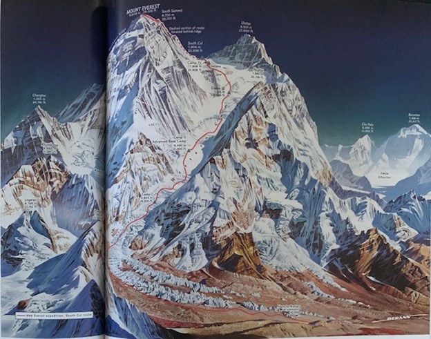
-Mount Everest- Khumbu Region- Sagarmatha National Park (Himalayan Mountains)
- Elevation 29,031.69ft. (8,848.86 m) above sea level
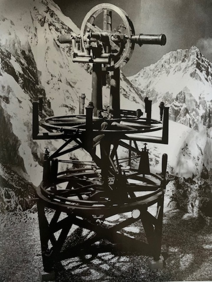
-19th century- Great Trigonometrical Survey of India (The Mountains Western namesake is surveyor, General George Everest, a British geographer.)
-Sagarmatha- “Mother of the Universe”- Nepal
-Qomolangma (Chomolungma)- “Holy Mother” -Tibet
-As of July of 2022- 6,098 different people have stood on the summit.
-Tenzing Norgay – Edmund Hillary 1st to summit (8 attempts- 13 lives lost)
-Conrad Anker, legendary mountaineer stated, “The culmination of terrestrial exploration… at a time when humanity needed relief from 2 world wars. “A unifying and inspiring event, signifying the drive to reach our greatest potential.”
-The region known as Khumbu who is occupied by the people of eastern Himalaya- Sherpa or Sharwa
-1st Map produced by National Geographic 1933.
Geology Overview
-Karakoram-Himalayan-Tibetan Belt boasts a number of geologic superlatives:
-It contains the highest mountains on Earth (14 higher than 26,00 ft or over 8,000 m.)
-Greatest relief of any continent
-Highest uplift rates
-Largest concentration of glaciers outside of the polar regions,
-World’s highest and biggest plateau
-Source of many of the world’s greatest river systems
“Little wonder this region has attracted geologists since the early days of exploration and surveying.” -David R. Lageson
Historical Geology
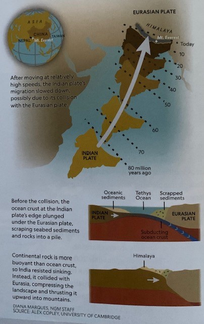
-Where Tibet and Nepal meet
-Eurasia àß_India
-1,500 (2,494km) miles the Himalayas stretch from West to East.
-Our story begins 200 million years ago.
-Pangaea began to split- India broke free and headed toward Asia.
-India plate moved fast geologically speaking 30 ft. (9.1 m.) each century.
-Tethys Ocean was located between the gap of Eurasia and India.
-Oceanic plate pulled south edge of Eurasian Plate- subducted zone.
-Slow slip of oceanic slab into the mantle scrapped a thick layer of marine sediments into a pile on the south edge of Eurasian plate. This sandy layer with marine sediments would be squeezed into rock and end up on the mountain’s peaks of the Himalayas.
-Around 50 million years ago- India’s plates speed declined, a shift many scientists interpret as early stages of plate’s collision with Everest.
-Marine sediments suggest Tethys sea closed 50-60 mya.
-Unlike an ocean plate, which is cold and dense, India’s continental plate is thick and buoyant.
-So as continents compressed and India pushed it’s way under Asia, the surface buckled and the crust thickened to form the Himalayas.
-Scientists continue to ponder over every bend, crack, and rock in the system, many mysteries have arose.
-Study of ancient magnetic patterns in the rock allows researchers to chart a continents position over time, and recent work using this method has revealed that when the mountain forming collision took place some 55 million years ago, India would have been sitting far south from Eurasia. That would leave a mysterious yawning gap between the two continents.
-Did the India plate collide with a now long-gone landmass that sat between the 2 larger continental blocks?
-Could the Indian plate’s northern edge have extended much farther that previously thought?
-Why was the Indian plate moving so fast before impact?
-India creeps two inches (50mm) each year.
-Ongoing impact with Eurasia might force the mountain to ever greater heights, with an estimated average uplift of roughly 0.4 inch (10mm) a year in northwestern sections of the range, and around 0.04 (1mm) per/yr at Everest.
-Growth can happen in waves, brought on by more violet shifts in the landscape. As India collides beneath Eurasia it doesn’t always collide by smoothly.
-When compressed, pressure builds until hits a breaking point. The breaking point and sudden release of pressure provides the opportunity for earthquake movement.
-Mount Everest doesn’t necessarily get tall due to earthquakes. Most likely it deconstructs. It depends on where and how the ground moves.
-According to 2015 satellite data, the earthquake may have caused both growth and destruction of the mountain.
-Erosion can play a critical role from wind, water, ice, and gravity washing the sediments into the streams below into Ganges and Brahmaputra Rivers.
-Sand drops out of the water as the slope diminishes at the mountains base in what is the largest river delta in the world, comparing the land that shifts under most of Bangladesh and the Indian state of West Bengal.
-Even as erosion and gravity keep the mighty mountains in check, tectonic plates maintain their geologic dance-and Everest will continue to follow their lead. – Maya Wei-Haas
Bedrock Geology
4 Distinct Layers
-Summit
-Yellow Band
-Everest Series
-Hard Core
The Summit
Sedimentary- gray, laminated, silty limestone and dolomite
-Swiss geologist-Augusto Gansser, stated late Paleozoic in age ~300 mya
-More recently geologist have noted invert fossils and stratigraphic layers and studies in southern China that state as old as Ordovician age ~470 mya.
Yellow Band
-Most recognizable
-Yellow-tan marble “Gold Wedding Ring” – It circles the peak.
-Below Qomolangma (Chomolungma) detachment fault and crops out below the south summit on the Southeast Ridge and below the first step on the Northeast Ridge
-Its about 650 ft (198m) thick, it’s a succession of interbedded dolomite marble and phyllite a fine-grained metamorphic rock with a silky sheen.
-Middle Cambrian in age ~30-40 million years older than the Ordovician rock of the summit.
Everest Series
-Primarily low-grade metamorphic rocks mudstone/ shale and thin beds of marble.
-Minerals: albite (common feldspar, include pegmatites- coarser 1cm to m), chlorite, epidote (found in association with marble, schist, hydrothermal vents from dense mafic composition), biotite, and quartz.
-Deep water sediments deposited on the continental shelf north of supercontinent Gondwana.
-River system may have been the source for sand, silt, and clay. (Much like modern Mississippi River System dumps into Gulf.)
Hard Core
Igneous and Metamorphic Rocks
-Greater Himalayan Sequence
-Easily seen along Lukla to Everest Base Camp
-Dark Metamorphic Gneiss- Found in deep gorges cut by Dudh Kosi River
-Steep Switchback trail leading up to Namche Bazaar
-Notice Migmatite- a metamorphic rock that was once partially molten.
-Stone steps cut into the near vertical hill sides between Namche Bazaar, Phortze, and Tengboche provide fresh outcrops of metamorphic minerals.
-Ama Dablam and beyond to the lower Khumbu Glaciers you will see white granite in the boulders along the trail.
-At base camp, the landscape becomes monochromatic- a black and white vertical world of white granite and ice.
-This is the exhumed core, the inners of the Mountain Belt or upper crust of India that was detached, metamorphosed, thrown back on itself to the south to form greater Himalaya.
Ridges & Faces
Mountain Everest and Himalaya rose from the Tethys Ocean tens of millions of years ago as they rose they formed ridgelines and faces that have been shaped from not just plate tectonic movement but also glacial movement which we will learn about shortly.
Ridges of Everest
Northeast Ridge
-Marks the top of the North Ridge.
-Subdivides North Face
-Separates Everest from Changste (North Peak)
- 1 mile (1.6 km)
-Succession of overlapping sedimentary rocks (like shingles on a roof)
West Ridge
-3 miles (4.8km) from summit to Lho La, a col between Khumbutse and Everest.
Southeast Ridge
-1 mile (1.6km) long curves downward to the south col, which separates Everest and Lhotse,
-Creates blunt steep slopes of rock.
Faces of Everest
-North Face
-Southwest Face- Steep
-Kangshung Face= Icy
Surveying Mount Everest
In 1856- Great Trigonometrical Survey- Project of Mapping and Surveying found by Indian subcontinent- mathematician Radhanath Sikdar found that Everest was the highest mountain in the world.
-Until the advancement of satellites, surveyors used a device called a theodolite- a precision optical instrument mounted on a tripod to measure angles between 2 designated points.
-Taking heavy equipment from mountain top to mountain top would measure height from sea level zig-zagging north from the Bay of Bengal until they could see the peak.
-In 1954 Survey 29,028 (8,848m) above seal level.
-In 1999 Bradford Washburn, cartographer and explorer, 1st to use GPS- 29,035ft (8,850m)
-In 2019 Nepal team used previous techniques and deployed a GPS receiver, ground penetrating radar to measure snow piled atop the rock.
-Team of surveyors at 8 different sites with clear view used laser theodolites.
-Survey Department of Nepal & China surveyed height of Mount Everest (Announced on 12/8/20)
-Surveyed height and found it to be 2 ft. higher (0.6m) than original height found in 2004.
-National Geographic Society stated that they adopted the latest measurement as Mt. Everest’s official height.
-However, NOAA and NASA produced different heights and aren’t ready to agree just yet.
Glaciers
-Home to the 3rd largest deposit of ice and snow after Antarctic and the Arctic.
-The mountains have been largely shaped by sculpting action of ice.
-Valleys are u-shaped after thousands of years of glaciers carving a path.
-Debris-covered glaciers dominate the valleys of high country.
-Lateral moraines run along the sides of the glaciers. (A common site in the upper Imja and other valleys.
-A series of parallel lines indicate the periods of glacial growth and retreat.
-The famous Tengboche Monastry is located on an ancient glacier terminal moraine where the glacier reached.
-Villages of Khumjung and Kunde are located in a valley that is all that remains of another vanished glacier.
-The spectacular face of the 22,349ft (6,812m) Ama Dablam (“Mother’s Necklace”) was found when several glaciers struck off in different directions from the summit region during the last ice age 12,000 years ago. Eventually carrying a “horn” similar to that of the Matterhorn.
-More recent evidence of this dynamic event can be seen in the devasting scouring, riverbank undercutting, and rocky depositions in the vicinity of Ama Dablam.
-In 1977, a glacial lake burst out in a flood that dammed the Imja River for several weeks.
-Torrents, or large gullies flooded periodically from excessive snowmelt or rainfall, have sliced their way down many a mountain slope.
-Avalanches, earthquakes, and tremors are all possible on Everest.
-Less dramatic are the landscapes marked by saturated soils moving slowly downward on steep mountain slopes, high above the trekking trails. Known as solifluction (moving soil) lobes, strange globular landforms as seen from the air or high up on a neighboring mountain.
Three Mountain Faces: Three Different Areas
The Southwest Face includes the Khumbu:
-Dry, eroded, human and cattle scorned
-Subtropical Asian monsoon climate
-80% of precipitation falls between June-September
-Inhabited by Sherpa people.
-Most of the annual climbs, treks, research, cleanup expeditions, TV specials, IMAX and Hollywood films, and special events
The North Face includes the Rongbuk:
-Dry and barren due to the topographic barrier that keeps out the monsoon
-Retreating glaciers much faster than south due to little moisture
-Early 20th century, British climbs scaled north side in Tibet Autonomous Region of China prior to Closing of Tibet ad Opening of Nepal in the late 1940’s and early 1950’s. Also a road that leads to Base Camp exists.
The Icy Kangshung East Face includes:
-It is the Gateway to the technically challenging Kangshung (East Face)
-Very difficult to access
-More remote and pristine
-Low pressure system sucks up the moisture during monsoon season up the Arun River and into the Kama Valley, creating conditions far wetter than those found in the Khumbu and Rongbuk.
-Old growth forest
-Larger mammals
-Only accessible a few months due to unfavorable weather conditions
-Snow blocks most of the passes
-200 foreigners visit the region per year.
-Full-force monsoon conditions.
Climate Change
-20 years ago the topic of climate change here was practically unheard of. Today in the Khumbu region alone, at least 22 new lakes have formed in the previously frozen landscape, and more than 20 existing ones have expanded.
-In 2019- 34 scientists and sherpas install world’s highest weather station at the balcony of Everest 27,657ft (8,430m) above sea level.
-A part of that team included National geographer Alex Tait that led a team that conducted the most accurate survey yet of Base Camp, the summit, and Khumbu Glacier.
-Using LIDAR (at type of laser screening) and photogrammetry (photography from multiple-angles) to craft a three-dimensional model that captured every detail down to nearly an inch- tents, rocks, and all.
-Glacialologist, Owen King, of the University of St. Andrews, in the U.K., compared the new images to historical photos from aerial surveys and declassified spy satellite.
-He then created a digital reconstruction of the surface of the Khumbu Glacier and 78 other glaciers near Everest dating back to 1962.
-The data not only serves as a baseline to quantify future ice loss across the region but also point to the mountain’s situation today. Since 1962, glaciers throughout the Himalayas have been melting.
-50% faster melt rate than 60 years ago.
-Warming temperatures a big contributor to climate change will most likely see temperatures at 1.8 degrees Fahrenheit (1 degree C) on the southern Himalayan slopes through the studied period.
-Ice is melting at altitudes above 20,000ft (6,096m)
-King states that at that elevation it should remain frozen solid year-round, snow should accumulate to feed into the glacial system.
-Not so much receding as they are thinning, losing ice from the top surface down, rather than retreating up valley.
-Snow accumulates like a conveyer belt in a glacier.
-Strange to think about, but thinning is less pronounced in the lower zones of many large Himalayan glaciers, where temperatures are warmer but the conveyer has built up a thick layer of rocky debris that shields the ice from the sun. Thinning is often most intense in the stretches of glaciers at higher elevation where there’s less debris cover, which leaves the ice vulnerable to melting in the rising temperature.
-A rocky cover isn’t always enough to protect the end of a glacier. At the end of the glacier a hill of gravel called an end’ terminal moraine forms.
-The barrier will catch meltwater, forming a proglacial lake that often accelerates melting of the glacier.
Innovation & Hope
-High altitude regions are vulnerable to water resources and the threat of climate change.
-Headwaters from Everest feed into Asia’s mighty rivers including: Indus, Ganges, Yangtze, Yellow, Brahmaptura- the Hindu Kush-Himalaya and Tibetan Plateau act as the water tower of Asia- 1.5 billion people depend on it.
-With Climate Change on the rise… What are the people below the mighty mountain to do?
-The people of Ladakh, a region of the Himalayas in northern India have hit upon a solution.
-Building huge ice cones that provide water into summer, when the glacial melt arrives.
-Shaped like Buddhist shrines, these “ice stupas”- the brain-child of engineer Sonam Wangechuck, who built the first one in 2013- are designed to stay frozen until the spring sun warms the fields, supplying 6.2 million gallons (10 million L) of water and irrigating 25 acres (10ha) of land a year.
“The pull of Everest was stronger for me than any force on Earth.”
-Tenzing Norgay
Do you agree?
Quick Sources
Byers, Alton C. “The Nature of Everest.” https://www.jstor.org/stable/mounresedeve.33.4.482
Kumar-Rao, Arati. “Make Your Own Glaciers.” https://fliphtml5.com/rtmqr/bqxa/2020-07-01_National_Geographic_Interactive/91/
Lageson, David R. “The Birth of Everest.” https://bioone.org/journals/mountain-research-and-development/volume-33/issue-4/mrd.mm125/The-Call-of-Everest--The-History-Science-and-Future/10.1659/mrd.mm125.full
MacDonald, Bernadette. “The Climbers of Everest.” https://www.amazon.com/Call-Everest-History-Science-Tallest/dp/1426210167
Mason, Betsy. “Explore Historic Mount Everest Expeditions Through National Geographic Maps.” https://www.nationalgeographic.com/adventure/article/maps-mount-everest-summit-anniversary-exploration-cartography-culture
Petri, Alexandra E. “From the Photo Archive: 65 Years of Epic Everest Climbs.” https://www.nationalgeographic.com/adventure/article/historic-mount-everest-expedition-photos-archive-culture
Wei-Haas, Maya. “Why Mount Everest keeps changing its height.” https://www.nationalgeographic.com/science/article/why-mount-everest-can-grow-and-shrink-plate-tectonics
Wilkinson, Freddie. He’s the last surviving member of the first expedition to summit Everest.” https://www.nationalgeographic.com/adventure/article/first-everest-expedition-kanchha-sherpa-nepal-perpetual-planet
“Inside the Everest Expedition that built the world’s highest weather station.” https://education.nationalgeographic.org/resource/real-time-data-mt-everest/
Kaitlin Murphy
THE KHUMBU: A TAPESTRY OF INTERWOVEN SOCIETIES, CULTURES, AND ENVIRONMENTS IN THE FACE OF GLOBALIZATION AND TREKKING TOURISM
Perched amidst the peaks of the Nepalese Himalayas, the Khumbu region presents a stunning landscape of stark beauty and potent cultural resonance. Home to Mount Everest (Furer-Haimendorf, 1975), this unique corner of the world has long served as a magnet for intrepid travelers and adventurers, its captivating vistas and resilient communities draw visitors from around the world (Byers, 1987). However, beneath the idyllic surface lies a complex tapestry of interacting societies, cultures, and environments, continuously evolving under the transformative influences of globalization and the burgeoning footprint of trekking tourism (Bhuju & Oh, 2015; Karki et al., 2015). This dynamic interplay between tradition and modernity, nature and human endeavor, presents an interesting case study for exploring the intricate relationships that shape the Khumbu's social and ecological fabric.
SHERPA ORIGINS
The Sherpa people are believed to be descended from nomadic groups who migrated from eastern Tibet to the Khumbu region around the 15th century (Bjonness, 1980). They settled in the Solukhumbu district, establishing villages amongst the Himalayan peaks, forcing them to adapt to a harsh environment characterized by extreme altitude, rugged terrain, and unpredictable weather (Karki et al., 2015). Their lives, deeply rooted in tradition and Buddhist philosophy (Furer-Haimendorf, 1975), are imbued with a profound respect for the natural world and a sense of reciprocal obligation towards the environment (Bhuju & Oh, 2015). Their reverence for the sacred landscapes manifests in their intricate cultural practices, including offerings to appease the mountain deities for safe passage on high-altitude journeys and adherence to strict environmental ethics (Karki et al., 2015).
The Sherpas have earned international acclaim for their profound knowledge of the Himalayas and their exceptional skills in climbing and trekking (Stevens, 1993). This expertise, honed through generations of practice and meticulous transmission of knowledge and techniques (Furer-Haimendorf, 1975), has played an instrumental role in numerous successful expeditions to Mount Everest and other peaks within the Himalayan range (Bjonness, 1980). Their ability to navigate treacherous terrain, endure extreme weather conditions, and provide crucial support to climbers has been integral to achieving mountaineering milestones and pushing the boundaries of human endurance (Rowan et al., 2015). The Sherpas' deep understanding of the mountain environment, coupled with their physical prowess and unwavering dedication, has cemented their reputation as the indispensable guides and porters of the Himalayas.
IMPACT OF TOURISM
The mid-20th century saw a significant turning point in Sherpa history with the arrival of large-scale tourism (Bhuju & Oh, 2015). This transformation was ignited by the 1953 ascent of Mount Everest by Tenzing Norgay and Edmund Hillary, an event that plunged the Khumbu region into the global spotlight (Byers, 1987). The subsequent influx of climbers and trekkers spurred a rapid shift in the regional economy, transitioning from a primarily agrarian society to one heavily reliant on tourism (Karki et al., 2015). This shift brought both opportunities and challenges, reshaping the social fabric of Sherpa communities and fostering a dynamic interplay between tradition and modernity (Stevens, 1993).
IMPACTS OF INFRASTRUCTURE DEVELOPMENT AND ENVIRONMENTAL DEGRADATION
One of the most visible impacts of globalization and tourism is the transformation of the physical landscape. Traditional villages have gradually given way to a burgeoning network of hotels, lodges, restaurants, and souvenir shops. This infrastructure, while catering to the needs of tourists, raises concerns about environmental degradation and the potential loss of the region's unique cultural heritage.
Infrastructure Development:
Land use change is a key driver of environmental degradation in regions experiencing rapid tourism development. Previously undisturbed land is cleared for construction, disrupting natural ecosystems, altering drainage patterns, and fragmenting habitats (Rowan et al., 2015). This fragmentation poses significant threats to the region's biodiversity, leading to population decline and extinction of vulnerable species (Bjonness, 1980).
Increased pollution is another major environmental consequence of tourism development. Construction and operation of tourist facilities generate substantial waste, wastewater, and air pollution, impacting the surrounding air and water quality (Stevens, 1993). Unsustainable waste management practices further exacerbate this issue, leading to litter accumulation and potential harm to wildlife through ingestion or entanglement (Byers, 1987).
Deforestation is another significant concern, driven by the demand for wood for construction and fuel. This deforestation contributes to soil erosion and landslides, jeopardizing the integrity of the natural landscape and increasing the risk of natural disasters (Furer-Haimendorf, 1975). To address this issue, the implementation of sustainable forestry practices is crucial to ensure resource availability for future generations and prevent ecological damage (Bhuju & Oh, 2015).
Furthermore, tourism development can lead to water resource depletion, placing a strain on the region's limited water supply. Tourist facilities rely heavily on water for various purposes, including sanitation, landscape maintenance, and recreational activities (Karki et al., 2015). This increased demand can exceed the region's water resources, leading to water shortages and impacting local communities. To ensure long-term sustainability, it is imperative to implement water conservation measures and explore alternative water sources, such as rainwater harvesting and water reuse technologies.
Environmental Degradation:
Waste management poses a significant threat to the Khumbu region's pristine environment. The influx of tourists generates substantial waste, including plastic, food scraps, and packaging. Inadequate waste management systems struggle to cope with this increasing volume, leading to litter accumulation across the landscape. This not only detracts from the natural beauty of the area but also pollutes waterways and harms wildlife, as animals ingest or become entangled in plastic debris (Byers, 1987).
Another consequence of tourism development is the accelerated retreat of glaciers in the Khumbu region. Rising temperatures, coupled with increased trekking activity and soot deposition from fuel burning, contribute to glacier melt at an alarming rate (Rowan et al., 2015). This poses significant risks, including water availability issues for local communities and potential glacial lake outburst floods, which can have devastating consequences downstream (Rowan et al., 2015).
Unsustainable trekking practices and deforestation have also led to soil erosion, a critical environmental concern. The loss of topsoil reduces land productivity and negatively impacts local agricultural communities, jeopardizing their food security (Stevens, 1993). Implementing sustainable land management practices, such as controlled grazing and terracing, and prioritizing afforestation initiatives are crucial to address this issue and restore the health of the region's soil.
The Khumbu region is renowned for its rich biodiversity, but this biodiversity is increasingly threatened by tourism development. Increased human activity and habitat fragmentation disrupt the delicate balance of ecosystems, potentially leading to species decline and extinction (Bjonness, 1980). Conservation efforts, including the establishment of protected areas and sustainable tourism practices, are essential to safeguarding the region's unique flora and fauna for future generations.
LOCAL INITIATIVES FOR SUSTAINABLE TOURISM
In recognition of the challenges posed by tourism, local communities in the Khumbu region have taken proactive steps to mitigate their impact and promote sustainable practices. These initiatives demonstrate a commendable commitment to environmental protection and long-term sustainability.
Waste Management:
- Waste Collection and Segregation: Implementing efficient waste collection systems with proper segregation at source has significantly reduced litter accumulation and environmental pollution (Bhuju & Oh, 2015).
- Waste Disposal and Recycling: Establishing dedicated waste disposal sites and promoting recycling initiatives have further minimized waste generation and its impact on the environment (Karki et al., 2015).
Eco-Friendly Construction:
- Sustainable Building Materials: Encouraging the use of locally sourced materials like stone and wood in construction projects reduces environmental footprint and promotes cultural preservation (Bjonness, 1980).
- Energy Efficiency: Implementing energy-saving technologies in lodges and tea houses, such as solar panels and biogas generators, minimizes dependence on fossil fuels and reduces carbon emissions (Stevens, 1993).
Responsible Trekking:
- Designated Trails and Route Management: Promoting well-maintained trails and designated routes helps minimize environmental damage and protects sensitive ecosystems (Rowan et al., 2015).
- Waste Minimization: Educational campaigns and regulations encouraging responsible waste disposal by trekkers are crucial in minimizing the impact on the fragile environment (Byers, 1987).
- Environmental Awareness: Raising awareness among tourists about the local environment and cultural practices fosters respect and responsible behavior during their treks (Nepal, 2015).
Community-Based Conservation:
- Tree Planting Initiatives: Community-led tree planting programs help restore degraded landscapes, mitigate soil erosion, and combat the effects of climate change (Furer-Haimendorf, 1975).
- Wildlife Protection: Engaging communities in wildlife conservation efforts, such as anti-poaching patrols and habitat restoration, protects endangered species and their natural habitats (Bhuju & Oh, 2015).
- Sustainable Resource Management: Implementing community-based resource management practices ensures the sustainable utilization of natural resources and promotes environmental stewardship (Karki et al., 2015).
These initiatives highlight the proactive approach taken by local communities in the Khumbu to reconcile tourism development with environmental protection. Despite the challenges, the Sherpa people continue to demonstrate resilience and adaptability. They are actively working to promote sustainable tourism practices, conserve their environment, and preserve their cultural heritage. Local initiatives offer a glimpse into a future where tourism can thrive alongside environmental protection and cultural preservation
NEGOTIATING TRADITION AND MODERNITY
The influx of tourists has presented the Sherpa communities with a complex mix of economic opportunities and challenges (Bhuju & Oh, 2015). In response to this new dynamic landscape, the Sherpas have exhibited adaptability by embracing new technologies and developing businesses specifically tailored to meet the needs of visitors (Karki et al., 2015). The presence of Western-style establishments like pubs and cafes juxtaposed with traditional Sherpa settlements reflects this ongoing negotiation between preserving cultural heritage and embracing modern developments (Nepal, 2015). This process of adaptation necessitates a delicate balance, ensuring economic prosperity while safeguarding the cultural and ecological integrity of the Khumbu region (Byers, 1987)
Karki et al. (2015), in their comprehensive study "Perceptions of trekking tourism and social and environmental change in Nepal's Himalayas," expose the diverse perspectives held by Sherpa communities regarding the impact of tourism. While acknowledging the undeniable economic benefits generated by the industry, the study highlights concerns surrounding environmental degradation, cultural erosion, and the emergence of social inequalities. The authors caution that the benefits of tourism are often unequally distributed, with a small segment of the community directly engaged in tourism reaping the most rewards, while others experience the negative impacts more acutely.
This analysis emphasizes the need for comprehensive and nuanced approaches to managing tourism in the Khumbu region, ensuring equitable distribution of benefits and mitigating environmental and social impacts. There is a growing movement within the Sherpa communities to ensure that the benefits of tourism are shared more equitably. This includes initiatives to promote local ownership of businesses, provide fair wages and working conditions for Sherpa guides and porters, and support education and healthcare initiatives within the community.
EVOLVING RELATIONSHIPS WITH TOURISTS
As tourism has grown, the nature of the relationship between Sherpas and tourists has undergone transformations. Traditionally, Sherpas and tourists engaged in reciprocal relationships based on mutual respect and obligation. However, with the rise of commercial tourism, the emphasis has shifted towards a more transactional relationship, where Sherpas are often seen as service providers rather than valued partners (Graham, 1992). This shift towards a transactional relationship raises concerns about the potential for exploitation and cultural misunderstanding and the long-term sustainability of tourism.
LOOKING FORWARD
The history of the Sherpa people is a testament to their deep connection to the land, their expert mountaineering skills, and their ability to adapt to changing circumstances. As the Khumbu region navigates the challenges and opportunities of globalization and tourism, the Sherpas continue to play a vital role in shaping its future. By drawing upon their rich heritage and embracing sustainable practices, the Sherpas are working to ensure that the Khumbu remains a place of breathtaking beauty, cultural vibrancy, and environmental sustainability for generations to come.
The Khumbu region serves as poignant example for exploring interconnectedness of societies, cultures, and environments in the face of globalization and trekking tourism. The region's unique history, traditions, and relationship with the natural world are constantly evolving in response to these external forces. Understanding these relationships is crucial for developing sustainable tourism practices, preserving cultural heritage, and ensuring the long-term well-being of the Sherpa people and their environment.
Works Cited:
Bhuju, D. R., & Oh, K. (2015). Tourism and sacred landscape in Sagarmatha (Mt. Everest) National Park, Nepal: Challenges and opportunities. Journal of Mountain Science, 12(1), 255-272.
Bjonness, I. (1980). The Sherpas of Nepal: Culture and environment. Himal Books.
Byers, C. (1987). The Impact of Tourism on Development in the Khumbu Region of Nepal. Mountain Research and Development, 7(3), 203-216.
Furer-Haimendorf, C. von. (1975). Himalayan Traders: Life in Highland Nepal. John Murray.
Graham, V. (1992). Tourism and Sherpas, Nepal: Reconstruction of reciprocity. Annals of Tourism Research, 19(3), 534-554.
Karki, R., et al. (2015). Perceptions of Trekking Tourism and Social and Environmental Change in Nepal's Himalayas. Journal of Sustainable Tourism, 23(1), 160-177.
Nepal, S. K. (2015). Irish pubs and dream cafes: Tourism, tradition and modernity in Nepal's Khumbu (Everest) region. Tourism Recreation Research, 40(2), 248-261.
Rowan, A. V., Egholm, D. L., Quincey, D. J., & Glasser, N. F. (2015). Modelling the feedbacks between mass balance, ice flow and debris transport to predict the response to climate change of debris covered glaciers in the Himalaya. Earth and Planetary Science Letters, 430, 427-438.
Rowan, D., Duckett, D., & Green, R. E. (2015). Landscape fragmentation and habitat loss: Impacts on plant diversity and ecosystem function across tropical and temperate biomes. Biological Reviews, 90(2), 528-553.
Stevens, S. (1993). The economic impact of tourism in the Khumbu region of Nepal. Journal of Travel Research, 32(2), 40-46
Donna Tully
IMPACT OF GLOBALIZATION ON LOCAL COMMUNITIES AND ECOSYSTEMS
From the moment I stepped off of the plane in Kathmandu (Nepal) to my departure 14 days later, my curiosities about this region were spinning in my head. All of my life I have referred to developing nations as “Third World”, a term from the Cold War that means “underdeveloped”. Little about this new place, so far, seemed underdeveloped. Being from rural West Virginia, I have experienced first hand (or so I thought) what an underdeveloped community is. I grew up with well water that reeked of rotten eggs, that stained our white clothes and deposited a reddish residue in our sinks, toilets, and tubs. My best friend’s house lacked proper sanitation. She had a bedside toilet in her bedroom that was used by her entire family of six and which they dumped daily in their backyard, not far from a mountain stream which were home for native salamanders.
The people in rural areas of West Virginia hunt for food, raise food in their gardens, and live off their land. Their livelihood depends on natural resources including coal, oil and gas, as well as timber. There is little consideration for conservation and protecting native species. Access to health care also has its inconveniences. I recall at the age of 14 my appendix was about to rupture. The nearest hospital was over an hour drive away on a windy, curvy backroad. Lucky for me, we made it in time. The “hillbilly” culture of where I grew up still prevails. The area was (and still is) quite depressing.
I spent my first three days in Nepal experiencing Kathmandu. Two words that best describe the experience are organized chaos. Mopeds and vehicles were buzzing around the streets with no street lights. Traffic police directed the chaos at a few larger intersections. Powerpoles were riddled with black electrical wiring and I felt immediate remorse for any electrician who may need to untangle the mess. The sidewalks were not maintained and the water was not suitable for this Westerner. I made the mistake of brushing my teeth using the sink water. I wasn’t swallowing the water, after all.
Amazingly it did not make me sick. All of the water I drank in Nepal came from bottled or boiled. One also does not put toilet paper into the toilet. Once you get out of Kathmandu, the toilets are either pit or gravity. It was hard to fathom the lack of sewage systems in the pristine areas we visited, especially given that hundreds of people trek in these areas on a daily basis. Based on these experiences, Nepal is underdeveloped, although the proper term is developing nation. I find it hard to believe that globalization - the movement of services, goods, people and information - have significantly impacted this nation. How could a developing nation not have potable water for its 30 million inhabitants and 900,000 tourists? I would soon learn there are other factors at play to include corrupt governments. The main impact of globalization would soon be evident to me - the prevalence of the English language throughout the nation.
One can only imagine the number of reforms in education Nepal has experienced as a result of globalization and the prominence of the English language. All of the schools we visited along our trek in the Himalayas taught English to children as young as kindergarten. All of our porters and guides spoke English. The majority, if not all, of the Nepalese people we encountered during the trek and in Kathmandu spoke English. Many of the textbooks in the schools were in English. One of the museums we visited in Khumjung was in English. My first thought was “how cool is that!” Upon further thought and research, the reason for speaking English and its implications are profound.
Tourism contributes significantly to Nepal’s economy and supports thousands of jobs throughout the nation, including remote areas. A great majority of tourists are English speaking. The ability to speak a second language also lends itself to engaging in social media and learning about the ideals of other cultures. Our trekking guides were well-versed with TikTok and I am now proud Facebook friends with most of my guides. Most of them post to social media in English.
Since my Nepal experience, I read how the English language can cause linguistic shifts which cause cultural shifts that are accelerated in the remote areas of Nepal with developments in technology and infrastructure. And, speaking of infrastructure, I was amazed at the number of buildings and amenities that we saw in Namche, as well as Gokyo. It would be like constructing a village in the middle of the Teton Mountain range! Adding, the ability to speak English influences where the young men and women of Nepal seek higher education and where they choose to raise their families. Globalization results in people seeking a ticket to prosperity and a better way of life at a loss of cultural identity. Language is often cited as an inherent component in personal identity as well as a concept of belonging (Toffin, 2014).
Other impacts of globalization were not as evident to me at the time. Looking back on the experience, it is obvious that the game of volleyball is quite popular - a game with its origins in Massachusetts (and dating back to 1895). We noticed volleyball courts in almost every village we trekked through. The menus we encountered in tea houses were “westernized”, offering pizza, hash browns, and chicken noodle soup. Most tea houses also served Coca-Cola and Snickers bars. The villages we trekked also sold “western” knock-off name brands like North Face, Patagonia, and Marmot, to name a few. Mobile phones were carried by all of our trekkers and porters. Most of the tea houses also had Wi-Fi and charging stations.
The fact there was an airport in the isolated village of Lukla that was fancier and more sophisticated than Ramechhap is another effect of globalization - the need for convenient air travel for tourists to access treks to Everest. I would remiss not to mention the coffee house in Lukla which was nicer than some of the coffee houses I have visited in the United States. The fact that all of the villages we trekked through had the ability to accommodate tourists in tea houses is additional evidence of globalization. In fact, Namche Bazaar had tea houses with names like “Comfort Inn” and “Holiday Inn” - definitely western influenced.
All of these amenities are to support tourism and with tourism come a lot of people from all over the world. Another amenity worth mentioning are the trekking trails. They were impeccable compared to the trails I recreate on in the United States. In fact, the majority of the trek was built with large stones and rock. We encountered actual stairs as we were approaching Gokyo. Imagine all of the time, resources and labor it took to build this trail system and the amount of money it takes to maintain it.
Nepal knew what it was doing when it built these trails - it knew it would attract people. And, with people from all over the world comes ignorance of a place. I recall while trekking outside of Dole coming upon a group of three men. I witnessed one of the men blowing his nose and throwing the tissue over the edge. I was appalled. How could someone do such a thing - trash this beautiful, pristine place? Too bad he did not speak English or I would have given him an earful. And, speaking of trash, it is an environmental issue through the remote regions of Nepal with no means to transport the trash out of the villages.
Globalization has also impacted the women of Nepal. When I was in fourth grade, I recall researching and sharing information about Hinduism. I recall the Hindu norms and values and how the Hindu culture toward women positioned them in society in that the woman’s purpose is to serve her husband and family. Another ideal that really struck me was that Hindu women were considered polluted during their menstrual cycle, were segregated, and were forbidden to worship in the temples.
My observations of the women in Nepal were that they were working and earning money for their families. I conducted some research about this and came across a fascinating paper authored by Manju Sharma (2015) that explores the changes in a woman’s way of life as a result of globalization and how that is seen through economy, media, society and culture. One of our trekking guides was a female and the owner of our trekking company was also female. While I did not think too much of this at the time, having two women in these roles speaks volumes about how globalization has impacted Nepalese culture and the role of women in society. I highly recommend reading this paper.
Indirectly, globalization, due to the movement of goods and people on a global scale causes carbon emissions which causes climate change, and climate change causes glacial recession and early snowpack melt both which result in erosion and variable water availability. These factors also result in habitat loss that results in loss of biodiversity, threatening native flora and fauna.
ECOSYSTEM-RELATED STEM LEARNING EXPERIENCES
Trekking in the Khumbu Valley was an unforgettable experience that has etched a permanent memory into my being. While I was well-aware of the impacts of climate change to mountain communities, including the Teton Valley community I currently reside, seeing firsthand the impact of glacial retreat and increased tourism was profound. I recall as we trekked from Lukla to Phangking to Namche the plethora of people and animals passing through and wondering, what level of compassion do these people have about the Khumbu Valley and the impacts we, as visitors and tourists, have on the area and, how many genuinely care?
Numerous threats to the ecosystems in Nepal are apparent, primarily due to the impacts of climate change, globalization (as previously discussed) and increases in tourism. All of these factors affect water quality, resources and availability in this once pristine region. It is through education and experience that visitors and non-visitors alike might gain compassion for this area. I am excited to engage my students to learn more about the Khumbu Region, as well as relate what they learn to the Teton Range, in which 11 active glaciers are found which have shrunk up to 55% in the past 60 years (Dayton, 2015).
Communities at high-elevation are some of the most susceptible and vulnerable to the impacts of climate change (Salerno, 2008). One such community includes Earth’s “Third Pole” (Yao et al., 2012) in the Hindu Kush-Himalayan Region and Tibetan Plateau, which contains some of the world’s largest ice masses outside of those found in polar regions. Likewise, this region is also referred to as the “Water Tower of Asia” (Viviroli et al, 2007), serving as the headwaters for vast rivers, including the Ganges, Indus, Brahmaputra, Yangtze, and Yellow. Communities in these areas are most vulnerable to glacial retreat caused by global warming. It is believed that pre-monsoon domestic water resources in the Khumbu Valley will increase short-term with glacial and snow melt but that water scarcity will become a major concern once the glaciers have melted, and with changes in precipitation (Wood et al., 2020).
Glaciers are considered “faithful” indicators of climate change due to their responsiveness to warming temperatures. One way to engage students in STEM learning experiences is presenting them with empirical data collected from various glacierized regions, including geospatial data, for them to evaluate and to draw conclusions. One powerful way for students to communicate their conclusions is through storytelling using ESRI Storymaps. One story map that deserves attention is “Peace and water in the Khumbu Region” (Hayes et al,. 2021). This story map highlights the idea of environmental peacebuilding to use natural resources as catalysts for building peace within and between communities, as opposed to association environmental issues as sources of conflict.
An effective STEM experience would have students collecting empirical data for a glaciated region and the impacts of climate change on water resources, biodiversity and ecosystem services and presenting the data in a story map through the idea of environmental peacebuilding and using Hayes’s et al. (2021) story map as an example. Likewise, students could choose an ecosystem threat to the Himalayas to research and develop their story. Additional sources for geographic information can be found at Global ecosystem mapping (n.d.), specifically Global Ecosystems Mapping (chapter 1, version) and A Glacier in Retreat (chapter 11, version 1). Furthermore, students could investigate the Himalayan flora and fauna, like the snow leopard, the red panda, the Asiatic bison, Bengal tigers, the Hanuman langur monkeys, ostracods, bioluminescent fungi, land leeches and rhododendrons, and tell their stories.
I also came across two wonderful lessons and resources in my research that could be used to develop lessons or as resources for students conducting research:
- Climate Change Impacts in Nepal - suited for my students in high school
- The mountains of Nepal: scientific investigation - for grades 5 and 7
- https://carolinaasiacenter.unc.edu/wp-content/uploads/sites/8684/2018/10/The-mountains-of-Nepal-Scientific-investigations.pdf
- Ecosystem profile: Eastern Himalayas Region
- Final Report: Nepal Study - ecosystems, development and climate adaptation
References
Dayton, K. (2015). Grand Teton National Park glaciers are melting. WyoFile. Accessed: Fri, Dec 8: https://wyofile.com/grand-teton-national-park-glaciers-are-shrinking/
Ecosystem Profile: the Himalaya region. https://www.cepf.net/sites/default/files/final.ehimalayas.ep_.pdf
Global ecosystem mapping. GIS for Science. (n.d.). https://www.gisforscience.com/chapter1/v1/
Global ecosystem mapping. GIS for Science. (n.d.). https://www.gisforscience.com/chapter11/v1/
Hayes, E., Gruver, J., Sharma, S. (2021). Peace and water in the Khumbu: Mitigating Conflict by Integrating Peacebuilding Tools into an Indigenous Water Management Framework. ESRI Storymaps. Accessed Mon, Dec 4: https://storymaps.arcgis.com/stories/790e04ae11a34428956e5589ef163ae1
Salerno, F., Buraschi, E., Bruccoleri, G., Tartari, G., and Smiraglia, C. (2008). Glacier surface-area changes in Sagarmatha national park, Nepal, in the second half of the 20th century, by comparison of historical maps, J. Glaciol. 54, 738-752.
Sayre, R., Frye, C., Karagulle, D., Krauer, J., Breyer, S., Aniello, P., Wright, D. J., Payne,
D., Adler, C., Warner, H., VanSistine, D. P., & Cress, J. (n.d.). A new
high-resolution map of World Mountains and an online tool for visualizing and comparing characterizations of Global Mountain distributions. BioOne Complete.
Sharma, M. (2015). Process and impact of globalization in Nepalese women. DhaulagiriJournal of Sociology and Anthropology9:128. doi:10.3126/dsaj.v9i0.14025
Toffin, G. (2014). Facing globalization in the Himalayas: belonging and the politics of self. Governance, conflict, and civic action: volume 5. Sage Publications.
Wood, Leah R., Neumann, K., Nicholson, K.N., Bird, B. W., Dowling, C. B., and Sharma, S. (2020). Melting Himalayan glaciers threaten domestic water resources in the Mount Everest Region, Nepal. Frontiers in Earth Science, Volume 8, Article 128.
Viviroli, D., Dürr, H. H., Messerli, B., Meybeck, M., and Weingartner, R. (2007).
Mountains of the world, water towers for humanity: Typology, mapping, and global significance, Water Resour. Res., 43, W07447, doi:10.1029/2006WR005653.
Greg Anderson
Reflection
Since Sir Edmund Hillary was able to conquer Mt. Everest in 1953, the Khumbu valley quickly grew to become a world-renowned place. Hillary’s conquest inspired and fascinated people to see the highest mountain peaks in the world and the sheer beauty of the Khumbu Valley. After summiting the highest mountain in the world, the number of visitors to this wonderful place started to increase at first through mountaineering expeditions and later through trekking. What once was a serene and sacred land, the Khumbu Valley grew to become one of the world’s most sought after outdoor expeditions.
The Khumbu Valley’s transformation through globalization wouldn’t have been as impactful without the influence of Sir Edmund Hillary. Hillary’s famous expedition was responsible for the construction of the Tenzing-Hillary airport in 1964, allowing visitors and supplies to arrive in the Khumbu Valley much easier than before. Hillary’s influence and love within the Khumbu Valley was inspirational through the establishment of transportation, education, and medical services to the area. Even after his death, the Hillary Foundation is still supporting the region and he will forever be remembered within the region for his humanitarian outreach.
The impact of globalization within the Khumbu region can be witnessed after stepping off the plane at the arrival at the Tenzing -Hillary airport in Lukla. An awe-inspiring setting of rugged mountainous landscape at the start of our journey was a breathtaking sight to start our adventure to Gokyo Ri. After leaving the airport and walking down the sidewalk into town, you are greeted with the influence of western culture as you are immersed into shops, lodging and eateries. As I walked through the streets of Lukla, globalization has influenced culture through the installation of an Irish pub, a modern coffee shop serving cappuccinos, a burger shop and shops selling brands such as The North Face to greet travelers on their journey into the Khumbu valley. Catering to the tourists that travel through the region and adopting to Western wants, needs and amenities was visible at first impressions.
Departing Lukla we started our journey to Phakding and then onto Namche Bazar. In Namche we checked into our tea hut for the evenings and were greeted by the owner, Pemba. Pemba was born and raised in Namche and has witnessed a once tiny agricultural village be transformed into the central hub leading tourists up to Everest and Gokyo Ri. Pemba described how the Khumbu valley origins were settled by eastern people of Tibet. In 1850, the trade with Tibet allowed for a cultural exchange within the Khumbu area, bringing in a new era of influence. Although trekkers came through the area for mainly mountaineering expeditions, it wasn’t until the 1990’s that trekking had changed Namche from a small, quiet village into a bustling village. Pemba described that a boom of trekkers to the region started coming in the 1990s and today roughly 60,000 tourists come to Namche annually. These tourists use the village of Namche as an acclimation day for altitude. In Namche, tourist population within the Khumbu valley is at its highest as tourists use Namche as central location to depart for Everest base camp and Gokyo Ri, who use it as an acclimation day or coming back on their return.
However, with the growing popularity of Everest and surrounding mountains and a road currently being built to Lukla to accommodate the needs of the Khumbu Valley, the region will forever transform allowing for increasing numbers of tourists, with access to increased supplies and growth to the region. Through the fascination to see the highest mountain peaks in the world, and the sheer beauty of the Khumbu valley, the number of visitors to this wonderful place is likely to increase as the valley’s transformation yields a more accessible and accommodating destination.
Although the Khumbu valley receives roughly 60,000 visitors annually, its ecological systems are met with sustainable issues. Since tourist numbers started to increase in the 1990’s, stress from waste left in the Khumbu has become an increasing issue. The Sagarmatha Pollution Control Committee (SPCC) established in 1991 realized that something needed to be done to manage the waste issue from all the visitors to the area. The SPCC partnered with Sagarmatha Next (opened 2022), a sustainable tourism center located in Namche Bazar, to educate guests on the impacts of tourism and solutions to reduce waste within the Khumbu Valley and the Sagarmatha National Park. Together, both of these organizations try to find solutions for waste management. With 60,000 annual visitors this brings roughly 790 kg of waste a day, and over 20,000 tons of waste per year. The SPCC has worked to keep the environment clean through waste management approaches including trail maintenance, increasing community awareness and participation, and finding ways to create waste reduction strategies through, reduce, reuse and recycling efforts. Sagarmatha Next waste management initiatives work with tourists to promote a waste carry back program where participants carry back 1 kg of waste back from Namche to Lukla.
The educational system I encountered in the Himalayas was astonishing. I was able to visit the school Lukla along with the Hillary school. The schooling at both of these schools was taken very seriously. Each school we visited had a headmaster and teachers who were educated at the university level along with a Nepal curriculum to follow. As a science teacher, it was fascinating to see the lab equipment that was accessible to the students. The Hillary schools had an assortment of chemical supplies along with beakers, graduate cylinders, and volumetric flasks (Figure 1). Electrical circuit equipment, human anatomy models, and earth science equipment were also available. Although the amount of science lab equipment in each school was less than mine, relevant high school experiments could still be achieved. When comparing the 9th and 10th grade science standards in Colorado to the equipment that was in the lab, I would be able to meet all the standards that I teach. Limitations in labs would occur in Honors or an AP class where I would have a difficult time being able to conduct higher-level labs due to the lack of equipment and technology. Each campus, however, did have a computer lab that could be utilized to access virtual labs to meet high lab techniques needed for more advanced Honors or AP classes.
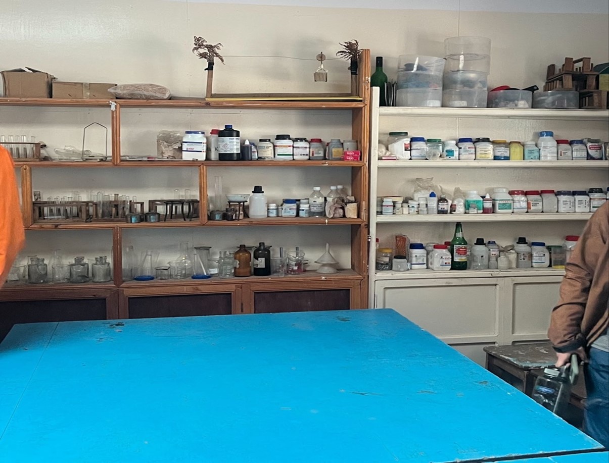
Figure 1. Hillary school’s chemistry lab equipment
When comparing school expectations for students between the two Nepal schools and my school in Colorado, I found more similarities than differences in categories of academic standards and school routines. This was surprising to see in a school in such a remote part of the world. I learned that the schools in Nepal follow a national standard for educational standards, compared to the state standards I follow in Colorado. School routines were similar in Nepal with elementary students staying with one classroom teacher all day long, while middle and high school students rotate to specialized classes. Students also had specials such as technology classes. Setting high expectations and goal setting for student success set a precedent at each school. The quality of student work that the teachers expected from students were set to an exemplary level (Figure 2). Examining the student work with a science focus, the models of the solar system (top left), climate change (top right), and phanerozoic eon (bottom right) have exquisite details.
Figure 2. Lukla school’s student work in science lab
Differences that I observed compared to my school was that students seemed to be engaged, attentive, respectful and hopeful for their future. It seemed like all of my schools guiding community agreements were being achieved. My school has guiding community agreements; respect, community, hope, and self-awareness. As I walked through each school, I observed these community agreements being upheld. The students from K-12 respect each other, listen to teachers' lessons and other students' ideas, while not being on their cellphones or talking to each other. I felt like each school had a sense of belonging, purpose and pride. At the Hillary school the headmaster was a K-12 student from that region that got his college degree in Education and decided to come back and educate the youth of his community. I felt like this pride in respect, community, hope and self-awareness was different than what I experience at my own school, where getting students to engage in school, have respect for others and self-awareness for how their actions might affect others is a working challenge at our school. The idea of hope was set through high expectations for the teachers at each school, with rigor and high expectations. I observed these school philosophies through an observation of a business class of 11th and 12th graders doing a cost-benefit analysis lesson in Lukla. At the Hillary school I observed the teachers preparing their lessons with considerable detail.
Visiting the Khumbu valley was an amazing experience to see how globalization has shaped the valley and is still shaping the valley today. As tourists descend upon the Khumbu each year to see the tallest mountains in the world, it will be interesting to see how the SPCC uses conservation efforts, and how Namche Bazaar will change in the decades to come. When the road to Lukla is complete, there will be seen a great transformation in the amount of goods and services brought to each village and will be able to help the local people for education, healthcare and other social opportunities.
Jessica Chute: Reflection
Title: Reflections on Field Experience: Exploring Societies, Globalization, Education, and Ecosystems in Nepal
Abstract:
This essay reflects on a transformative field experience in Nepal, examining the intricate tapestry of societies, the pervasive impact of globalization, the distinctive education system, and the ecosystem-related topics ripe for STEM learning. Delving into the multifaceted dimensions of this journey provides the opportunity to learn from the depth of insights gained and their broader implications.
Introduction
Background of the Field Experience
Setting the Stage: The Himalayas and the Khumbu Valley
Nepal, with its majestic Himalayan range, serves as a captivating backdrop for this field experience. The towering peaks in the Khumbu Valley, a cradle of Sherpa culture, provided a beautiful, complex, and portentous stage for profound exploration.
Objectives of the Field Experience
The primary goal of the trip was to experience an incredible trek to Gokyo Ri in Sagamartha National Park, undertaking a physical, mental, and emotional journey with fellow MSSE classmates. The academic goal of this journey was understanding the interconnected nature of societies, recognizing and evaluating the impacts of globalization in the region, researching the local schools and comparing educational systems to our US experiences, and identifying ecosystem-related STEM topics unique to the Khumbu Valley region compared to our home states. These objectives guided the experiential learning journey, providing a structure for meaningful engagement.
An Evaluation of Societies, Cultures, and Environments
Religious, Cultural, and Legal Mandates
No Harm to Animals in Sagamartha National Park
The starkest contrast between US society and the Khumbu Valley was the Sagamartha National Park’s commitment to the Buddhist Tennent of non-violence. This Buddhist doctrine is encoded into law for the National Park area in the Khumbu Valley. This law encompasses its treatment of animals, a facet deeply rooted in religious and cultural frameworks. The ethos is particularly evident in the doctrine of prohibiting the slaughter of animals for meat, offering a stark contrast to practices in other regions of Nepal, and other countries in the region and around the world.
Dietary Preferences and Challenges
Navigating the intersection of global tourism and local laws, customs, and supply chains reveals interesting dynamics. The diet foreigners are accustomed to, often distinct from the local fare due to the prohibition of animal harm (slaughter), pose both challenges and opportunities for cultural exchange. Meat that tourists are accustomed to must be carried in by porters from outside the national park. This form of transportation combined with a lack of infrastructure for proper refrigeration means meat that is available for consumption by tourists may not be entirely hygienic, and it is often recommended to foreigners by their guides that they not consume meat when deep in the park. Observing how communities accommodate these differences sheds light on the delicate balance between preserving cultural authenticity, catering to the needs of a global audience, and addressing the imbalance of resources inherent in the tourism of a developing country by comparatively wealthy foreigners.
Treatment of Stray Dogs: A Compassionate Approach
Unlike the harsh and cruel treatment used elsewhere, the Khumbu communities adopt a gentle and compassionate approach to stray dogs. This nuanced interaction not only ensures the relative safety of humans but also fosters a unique coexistence between communities and animals. As a result, feral dogs in these regions seldom exhibit aggression. The cultural acceptance and humane treatment they receive contribute to a harmonious cohabitation, prompting reflections on the potential broader applications of such philosophies.
Requirements of Foreigners and Cultural Sensitivity
The Intersection of Hinduism, Buddhism, and the Yeti Myth
In the heart of the Himalayas, the coexistence of Hinduism and Buddhism intertwines with local folklore, giving rise to captivating legends like that of the Yeti. The majority of the population of Nepal, around 80%, are Hindu, while a portion of the remainder are Buddhist, which includes the historically Tibetan Sherpa population of the Khumbu Valley. The Sherpa have a relatively modern folktale of the Yeti that has been incorporated into their Buddhist beliefs, complete with a 300-year-old brown Yeti scalp displayed in one of their most sacred Buddhist temples in the Khumjung monastery. The Sherpa both revere and fear the Yeti, with legend claiming a Sherpa village girl being attacked and her yaks meeting their end by a Yeti in 1974. Exploring the syncretism of these religions and the cultural significance of mythical creatures provides a lens through which to appreciate the deep-rooted spirituality shaping daily life.
Sherpa and Rai Communities: A Closer Look at Their Histories and Beliefs
The Sherpa and Rai communities, with their unique histories, offer a rich tapestry of cultural narratives. Understanding the dynamics within these communities unveils the complexities of social structures, traditions, and the impact of external influences on their way of life. As more and more Sherpa look for employment opportunities outside of the dangerous and demanding world of guiding, other groups are stepping in to fill those vacancies. 90% of the guides working today are Sherpa, but the other 10% are Rai (including one of our guides Sonam), or other ethnicities.
Sonam’s family offered us a unique look into the lives of residents in the Khumbu valley. Sonam and his family are of the Rai ethnic group. Having slightly different traditions than Sherpa, they are originally from other parts of the region outside of the Khumbu Valley. As jobs and opportunities have opened up, some, like Sonam, have moved in. Sonam, his wife, his sister, and several other relatives maintain a teahouse in the Khumbu Valley where they work from and raise their children during the guiding season. In the off season, they retreat to their home outside the Khumbu Valley, where it is ostensibly warmer and is subject to a milder winter than the harsh Khumbu region.
We were able to see the values and benefits of communal family living, with multiple “nuclear” family units living in the house and participating in family life together. When Sonam’s son hiked with us, Sonam claimed either his wife or his sister-in-law had braided his son’s waist length hair, a cultural custom where a boy’s hair is not cut until he is 10 years old. His response showed how interconnected the family was, in opposition to the Western nuclear family where the concept of expecting an aunt to provide a daily task for a child is rarified.
We were also witness to the large family unit participating in momo preparation together, a time consuming and labor-intensive process of making delicious individual dumplings. This practice and the food itself highlighted the expectation and benefit of a multi-family living unit: with so many hands, the otherwise daunting process of making momos was completed quickly.
The Sacredness of Mountains
Rock Scriptures and Prayer Flags
The sacredness of the mountains as seen by the Sherpa people is honored in a variety of ways. The most permanent is inscribing stone tablets with passages of thanks, reverence, and appreciation in Tibetan script. Another is painting those same scriptures in black ink on large boulders that have been painted white. The last and most colorful is planting poles with vertical prayer flags along the roads and trails. All of these forms of respect are honored by residents and tourists alike by walking around them in a clockwise fashion, regardless of the direction of travel or which side of the trail they reside.
Sherpa Rituals and Forgiveness for Climbing Sacred Mountains
The sacredness attributed to the Himalayan mountains manifests in a prohibition of climbing them. This a worldwide theme among indigenous mountain people, with Native Americans discouraging climbing of Devil’s Tower in Wyoming, and requesting a voluntary prohibition for the month of June. The Quechua people of the Andes in South America also do not climb their mountains, going so far as to refuse potential economic gain by guiding tourists in them.
Sherpa religion shares this prohibition, but unlike other communities provides a mechanism for exemption in the form of forgiveness, permitting the local people to monetarily benefit from Western mountaineering tourists who would climb their sacred mountains with or without their
Sherpa guides. This ritual built into the Sherpa’s sect of Buddhism allows them to create an economically sustainable business: if they keep their clients alive, they can bring them back again and take more of their money for it. An exploration of these practices reveals a profound connection between spirituality, the environment, culture, and economy. Witnessing Sherpas seeking forgiveness for climbing these revered peaks underscores the intricate balance between tradition and the evolving landscape.
Impact of Mountaineering on Local Culture
As the global fascination with mountaineering grows, the impact on local peoples becomes pronounced. Mountaineering is an incredibly dangerous profession, and while the clients the Sherpa guides lead are there for the passion and attainment, the Sherpa are there because it is their home and it is a job. Recently there is a noticeable shift in the perspectives of the Sherpa community, grappling with the economic opportunities presented by mountaineering against the backdrop of safety, economic security, and longevity. The tensions between economic opportunity and personal wellbeing are being thrown into stark relief, prompting contemplation on the sustainability of the industry in the face of evolving global dynamics.
The Impact of Globalization on Local Communities and Ecosystems
Nomadic and Agrarian Past
Sherpa are historic Tibetans who migrated across the Himalayas to escape religious persecution. Traditionally traders linking Tibet and Nepal living in remote subsistence agrarian communities. The boom of mountaineering as explosively shifted their economy and lifestyle to support tourism. With that has come rapid changes in the use and requirements of infrastructure.
The influx of western tourists and their accompanying technology has forced Khumbu residents to meet their needs and expectations or risk losing their invaluable business.
Tourism and Population Explosion
Sagamartha National Park and Changing Dynamics
The Sagarmatha National Park, once pristine and secluded with its peaceful, agrarian communities now grapples with the consequences of heightened global interest. The changing dynamics within this protected area led to friction between local customs and regulations and external, often international demands and expectations. From strict regulations to the challenges created by increased visitation, examining how globalization reshapes the relationship between humans and the natural environment raises critical questions about sustainable growth and conservation.
Trail Maintenance and Its Significance
The influx of tourists not only impacts waste management but also necessitates a reevaluation of trail maintenance and trail building practices. Increased footfall requires sustainable, durable, and economically viable approaches to ensure both the safety of visitors and the preservation of natural habitats. Analyzing the evolving strategies in trail maintenance provides a lens through which to understand the delicate balance between accessibility and conservation.
Infrastructure Development and Evolving Expectations
Roads vs. Trails
The Valley has no true roads nor vehicles, utilizing a highly developed network of stone set pathways and dirt trails. This means supply chains and transportation are provided by simple and old-fashioned means, or ultra-modern and expensive means. Human porters and pack animals carry in the vast majority of food, materials, and goods, with issues of cost effectiveness vs economic security for those employed becoming apparent. The alternative is helicopters.
These machines are a necessity in the high alpine mountaineering industry, and the need has increased access for the rest of the Valley. Emergency helicopter evacuations for ill tourists are always turned into supply drops to these remote, high alpine villages, and helicopters are hired out for transporting equipment and materials for big construction jobs. That said, little to no heavy equipment exists in the area, with stone milling and setting in road construction all performed by hand with some power hand tools and primarily the old-fashioned hammer and chisel. The lack of true infrastructure and transportation creates a precarious balance between archaic and modern, and leaves a gaping hole in the supply chain that most high-traffic tourist destinations do not have to deal with.
Sewage and Water
The explosion of visitors to the Khumbu Valley has created an issue normally only seen in heavily populated cities: too much sewage with nowhere to put it. The Valley is unique in that it supports 60,000 visitors annually while it’s geology and weather make solving the sewage crisis expensive and potentially impossible to solve. The area is rock, making digging down into it to put in sewage fields expensive or impossible without heavy equipment, which is also expensive or impossible to source. Thus, sewage is dealt with the way it has been historically, being dumped into shallow pits, or sometimes the surface of the ground. This obviously causes toxic runoff into waterways at the volume of people this area experiences these days, which poisons the water supply.
Traditionally bathing, washing, and drinking all happened at public streams and springs, as the population density did not overwhelm the ecosystem and health issues were less of a concern. With the uptick in visitation caused by mountaineering and trekking, the volume of waste that has nowhere to go has filtered into the ground water, making the historically pure water unsafe to consume. Water for tourists must be boiled or treated, and health issues caused by the water are a concern for tourists and residents alike.
Electricity
The increase in visitation and the rapid development of electronic technology has created a new need in this remote area. A place with no vehicles, where house foundations are stones set by hand, the people rely heavily on modern solar technology to both run their businesses in modern times and to satisfy their customers. The remote nature of the Valley also means local hardware stores that would supply materials for a dysfunctional solar system don’t exist. If a business doesn’t have a big enough battery bank to supply enough electricity to the whole teahouse, it introduces timed blackouts to preserve electricity. If it rains for six days in a row, there is no sun to sufficiently charge the power banks, and use must be restricted to preserve electric power.
This lack of consistent electricity leads to poor food preservation conditions compared to what many tourists are used to, impacting their experience in multifaceted ways.
Trash Management and Recycling Initiatives
The Role of the Sagamartha Recycling Center
Globalization brings economic opportunities as well as environmental challenges. The Sagamartha Recycling Center is a new player in addressing the corresponding growth in waste generated by the exponential influx of tourists. Examining the mechanisms and effectiveness of this initiative provides insights into the cultural, economic, and physical barriers in place to maintain environmental sustainability for the region in the face of globalization.
Challenges and Successes in Waste Management
The most directly successful project of the Sagamartha Recycling Center is the Carry Me Back program. One kilogram of recyclable waste is offered to visiting hikers, to be carried out of the Khumbu Valley from Namche Bazaar and deposited at a collection center at Lukla. While the recycling center aims to mitigate the negative environmental impact the area is experiencing, challenges persist and the program is only one small piece of a much greater, complex problem. From the logistical challenges of waste disposal in mountainous terrain to the necessary cultural shift towards sustainable practices, there are many and multifaceted aspects of managing the ecological footprint left by an expanding global presence.
Balancing Cultural Preservation with Economic Opportunities
The economic benefits brought by tourism often come at the expense of cultural history and economic sustainability. The delicate equilibrium required to harness economic opportunities while safeguarding the cultural integrity of local communities is a difficult one to find.
Responsible tourism practices, i.e. leaving rocks and other found items in the park and not taking them home, are essential in fostering mutual respect between visitors and hosts and for continued viability of tourism in the region. There will soon be no mountains to visit if 60,000 tourists remove 90,000 pieces of mountain in the form of three rocks each that are taken home.
A Comparative Analysis of Educational Systems
Relevance of Subjects in Nepali Education
Alignment of Subjects with Students' Future Needs
Nepal's educational system reflects a pragmatic approach to curriculum design. Subjects in schools in the Khumbu Valley are selected based on their direct impact on students' future lives. Delving into the rationale behind prioritizing certain subjects over others, shows how this approach aligns with the socio-economic landscape and the needs of Nepali youth.
Subjects Prioritized Based on Practical Impact
Unlike some Western education systems that may emphasize theoretical subjects, Nepali classrooms focus on practical knowledge. From accounting to social sciences, the curriculum aims to equip students with skills directly applicable to their daily lives and future careers. By examining the practical orientation of the curriculum, teachers can to unravel the interconnectedness between education and societal needs and highlight changes they can make in their own classrooms.
School Breaks and Cultural Influences
Aligning Breaks with Hindu Holidays in a Buddhist Region
The synchronization of school breaks with Hindu holidays in predominantly Buddhist regions shows a mirror image of the US education system following a Christian calendar in a religiously diverse country. Exploring how an education system other than one’s own navigates the coexistence of diverse religious practices can help realize the importance of sensitivity required supporting students with school breaks that misalign with students’ own culture.
Winter Break Duration and Its Correlation with Weather Conditions
The extended winter break in Khumbu schools is not merely a reflection of the academic and Hindu calendar but also a response to the harsh weather conditions. Many Khumbu residents retreat to the relatively mild climate of Kathmandu for the harshest winter months that are synced with an extended school break. This event highlights the practical considerations influencing the academic calendar, shedding light on the intersection of education, climate, and cultural practices.
The Edmund Hillary School and Teacher Dynamics
Role and Significance of the School
The Edmund Hillary School stands as a testament to the global collaboration in education. The school's mission, its impact on local communities, and the role it plays in bridging cultural gaps are profound and speak to Sir Hillary’s vision and passion for the region. Delving into the objectives and outcomes of this unique educational initiative uncovers the potential benefits and challenges associated with non-local educational interventions.
Challenges and Benefits of Non-local Teachers
While the introduction of non-local teachers due to the government education system brings diversity to the educational landscape, it also presents challenges. The dynamics between teachers from different cultural backgrounds and local communities are subtle but can be both profound and pervasive. These interactions contribute to a richer educational experience for students while the potential pitfalls of cultural misalignment can create avoidable setbacks.
Identifying Ecosystem-Related Topics for STEM Learning
Farming at Elevation and Its Challenges
Field Maintenance, Growing Season, and Crop Varieties
Farming at high altitudes presents a unique set of challenges and opportunities. The intricacies of cultivating crops in the elevated region of the Khumbu are even more extreme than other mountainous areas due to its unique infrastructure. Examining the methods of field maintenance, the constraints of a shortened growing season, and the varieties of crops that thrive in such environments have been mastered by hundreds to thousands of years of familiarity and flexibility of the Sherpa people. The cultural memory of these agricultural practices for sustainable, subsistence food production and the resilience of the Sherpa communities could be under threat in the rapidly shifting economy of international tourism.
Comparative Analysis with Students' Home States
Drawing parallels between farming practices in Nepal and students' home states fosters a cross- cultural understanding of agricultural ecosystems. By juxtaposing the challenges and innovations in different regions, potential lesson plans would highlight the importance of sharing knowledge and collaborating on solutions to address common issues in agriculture.
Timing of Seasons and Its Impact
Contrasting the Onset of Seasons in Nepal and Home States
Observing the timing of seasons in Nepal compared to students' home states reveals not only meteorological differences but also the profound influence of geography on ecosystems. This lesson plan would explore how variations in seasonal patterns impact biodiversity, agricultural cycles, and overall ecosystem health, prompting reflections on the interconnectedness of global ecosystems.
Observations on Climate Patterns and Implications
Analyzing climate patterns goes beyond mere meteorological observations. It involves understanding the ecological consequences of these patterns. A climate change lesson including a more extreme environment like the Nepali Khumbu Valley would delve into the implications of climate variations on flora, fauna, and human communities, emphasizing the urgency of addressing climate change as a global challenge that transcends geographical boundaries.
Geology of the Himalayas Mountains of Montana
Key Differences and Similarities
Comparing the geological features of the Himalayas with those of the mountains in Montana unveils fascinating parallels and distinctions. Investigating the geological forces that shaped these landscapes, exploring how geological diversity contributes to the richness of life would broaden and deepen students’ understanding of ecological systems. By understanding the unique geological characteristics of each region, students gain insights into the factors influencing biodiversity and landscape formation.
Geological Significance and Educational Opportunities
The geological diversity provides not only aesthetic beauty but also educational opportunities. Opportunities that explore how the distinctive geological features of the Himalayas and Montana can serve as engaging platforms for STEM learning. From rock formations to geological processes, students can delve into hands-on experiences that deepen their understanding of Earth's dynamic processes.
Fossils: Presence or Absence in MT Himalaya
Exploring the Fossil Landscape in Both Regions
Investigating the presence or absence of fossils in Montana and the Himalayas unveils the geological history embedded in these landscapes. The fossil record of each region is vastly different due to different geological processes, exploring the remnants of ancient life that provide valuable insights into the evolution of geology and ecosystems over time. By comparing the types of fossils and their distribution, students can draw connections between geological history and contemporary biodiversity.
Impact of Climate Change on Himalayan MT Mountains
Observations on Climate Change Effects
As climate change accelerates, its impact on mountainous regions becomes increasingly pronounced. A lesson on this subject observes the visible effects of climate change on both the Himalayas and Montana's mountains. From glacial retreat and snowpack instability to changes in vegetation patterns, students gain firsthand insights into the environmental transformations occurring in these sensitive ecosystems.
Conclusion
Key Takeaways
Insights from the Field Experience
The immersive journey in the Himalayas and the Khumbu Valley offered profound insights into the interconnected nature of societies, cultures, and environments. Contrasts in the treatment of animals, dietary practices, and compassionate approaches to stray dogs highlighted unique cultural nuances.
Implications for Future Educational and Experiential Initiatives
The experience laid the groundwork for future educational initiatives, emphasizing the importance of global awareness, cultural sensitivity, and collaborative learning. The identification of ecosystem-related STEM topics provided a rich foundation for designing engaging curricula.
Reflections on Societal Interconnectedness
The evaluation of societies and cultures revealed the delicate balance between spirituality, cultural practices, and economic sustainability. Cultural intersections, such as Hinduism, Buddhism, and the Sherpa and Rai communities, showcased the diversity of beliefs and histories, fostering a deeper understanding of societal dynamics.
Navigating the Impacts of Globalization
The exploration of globalization's impact on local communities addressed challenges in infrastructure, waste management, and the delicate equilibrium between economic benefits and cultural preservation. Reflections on mountaineering underscored the tensions between economic opportunities and personal well-being, prompting contemplation on the sustainability of the industry.
Comparative Analysis of Educational Systems
The comparative analysis of educational systems provides a lens through which to evaluate the relevance and adaptability of curricula. Nepali education, with its emphasis on practical skills and alignment with local needs, challenges traditional paradigms in Western education models. The goals of schools in the Khumbu Valley contrast with some Western models by prioritizing practical knowledge over theoretical subjects. The cultural considerations and the impact of weather conditions scheduling breaks are also a stark signifier of practicality.
Ecosystem-Related STEM Learning
Identifying key ecosystem-related topics for STEM learning, such as farming at elevation, seasonal variations, geological features, fossil landscapes, and the impact of climate change, offered a comprehensive understanding of environmental challenges. Comparisons with students' home states highlighted the importance of cross-cultural collaboration in addressing shared issues.
Final Reflections
In conclusion, this field experience provided a unique lens into the complexities of the Khumbu Valley and offered valuable insights for future educational initiatives. The journey emphasized responsible tourism, sustainable practices, and the imperative to balance economic opportunities with cultural preservation for the continued viability of this unique region. The interconnectedness of global ecosystems and the need for collaborative solutions are central themes, shaping a holistic perspective beyond traditional classroom boundaries.
Citations
Chute, Jessica. Personal Notes from Oct 1. – Oct 12, 2023, Nepal.
ChatGPT
Jessica Chute: Lesson Plan 1
Lesson Plan 1: Blood oxygen concentration variance by elevation
Background:
Blood oxygenation levels are shown to vary along elevational gradients, with low blood O2 levels at high elevations leading to physical illness if beyond the capacity of that individual.
Objectives:
Students will be able to:
Identify patterns in blood oxygenation along an elevational gradient. They will be encouraged to develop ideas about why these patterns exist.
Vocabulary:
Acclimatization – the period of time that allows for adjustment to a new environment on a physiological level
Altitude – is the vertical distance of a point or object above a reference level Altitude sickness – the negative effects of high elevation on the human body Baseline – a minimum or starting point used for comparisons
Blood oxygenation – the amount of dissolved oxygen in one’s blood from respiration (breathing)
Elevation – Elevation is distance above sea level. Elevations are usually measured in meters or feet. They can be shown on maps by numbers giving the exact elevations of particular points on the Earth's surface
HAPE/HACE – High Altitude Pulmonary/Cerebral Edema, aka extreme altitude sickness Hypoxemia – a state of low blood oxygenation that can be extremely dangerous and have negative effects on brain and lung function
Pulse Oximeter – a device used to measure the concentration of blood oxygen
Materials:
Pulse oximeter
Pen/pencil and paper for recording results
Safety precautions:
Bring plenty of water and snacks
Bring sunscreen or sun coverings for higher altitudes
Chaperones should know and be able to recognize the symptoms of altitude sickness and be able to respond and potentially treat a case.
Engagement
Begin by explaining vocabulary terms: elevation, blood oxygenation, pulse oximeter and altitude. Discuss why blood oxygen concentration could be important and how and why elevation might affect it.
Exploration
This lesson takes place over the course of several weeks at different locations. Students will start at sea level for several weeks as a baseline. They will measure and record all of their blood oxygenation levels with a pulse oximeter. After this baseline is set for sea level, they will move to a new elevation, i.e. 4000 feet. They will measure their blood oxygenation immediately and the next day. Once these measurements are complete they will move again to a higher elevation,
i.e. 7000 feet. They will repeat this process every two days until there are no easily accessible elevations available or the elevation change would be too dangerous, whichever comes first. Once these measurements are complete, students will return to their home elevations. They will measure their blood oxygenation again immediately at their home elevations and again after being in their home elevation for two weeks.
Explanation
Once students have finished their measurements it’s time to share and compare the data. Consider the following questions:
Which elevation had the lowest blood oxygenation? Which sites had greatest difference in O2 levels?
List possible reasons for variations in O2 levels among peers at each elevation.
Expansion
At this point introduce the rest of the vocabulary terms and discuss how they relate to the data the students just collected: Acclimatization, altitude sickness, HAPE/HACE, hypoxemia, elevation
Evaluation
Students complete data sheets with observations. Note any trends in blood oxygenation along the altitudinal gradient. Also note any trends in blood oxygenation between those with higher and lower home elevations. Students written reflections should display an understanding about why the data from different elevation sites might vary and the implications of this variation.
Extensions
Students can write reports on the effects of different blood oxygen levels. They can discuss the history, the physiological effects, the symptoms, or the treatment of HAPE and/or HACE. They can also explore the history and study of acclimatation. Further lessons can be structured exploring varying acclimatization times to see the effect on blood oxygenation levels.
Jessica Chute: Lesson Plan 2
Boiling time of water at varying elevations
Background:
Partial pressure affects how long it takes to boil water at varying elevations above sea level. This lesson introduces those concepts to students in an engaging, active way.
Objectives:
Students will be able to:
Identify patterns in boiling time along an elevational gradient. They will be encouraged to develop ideas about why these patterns exist.
Vocabulary:
Altitude – is the vertical distance of a point or object above a reference level Baseline – a minimum or starting point used for comparisons
Boiling point – the temperature at which a substance changes phase from liquid to gas Elevation – Elevation is distance above sea level. Elevations are usually measured in meters or feet. They can be shown on maps by numbers giving the exact elevations of particular points on the Earth's surface
Partial pressure –a measure of thermodynamic activity of the gas's molecules. Gases dissolve, diffuse, and react according to their partial pressures but not according to their concentrations in gas mixtures or liquids.
Materials:
Stove Fuel Ignition Beaker Water
Safety glasses Hot mitt or tongs Thermometer
Pen/pencil and paper for recording results First Aid kit
Safety precautions:
Bring plenty of water and snacks
Bring sunscreen or sun coverings for higher altitudes
Students should be educated on the risks of boiling water and hot pans
Engagement
Begin by showing two, time synchronized videos of identical beakers of water being brought to a boil at different elevations. Have students reflect on what they observe in the videos.
Exploration
This lesson takes place at several different locations. Students will start at sea level if possible as a baseline. They will measure and record the boiling time of water at the lowest elevation available to them. After this baseline is set for sea level, they will move to a new elevation, i.e. 2000 feet. They will boil water and time it again. Once these measurements are complete they will move again to a higher elevation, i.e. 4000 feet. They will repeat this process until there are no easily accessible elevations available or the elevation change would be too dangerous, whichever comes first. Geographically isolated classrooms or students could use remote resources to gain access to additional elevational measurements.
Explanation
Once students have finished their measurements it’s time to share and compare the data. Consider the following questions:
Which elevation had the fastest time? The slowest? Which sites had greatest difference in boiling time?
List possible reasons for variations boiling times at each elevation.
Expansion
At this point introduce the vocabulary terms and discuss how they relate to the data the students just collected. Encourage students to discuss the ramifications of their observations with their knowledge of the new vocabulary.
Evaluation
Students complete data sheets with observations. Note any trends boiling times along the altitudinal gradient. Students written reflections should display an understanding about why the data from different elevation sites might vary and the implications of this variation. Advanced classrooms can explore mathematical and statistical models for any trends observed,
Extensions
The lesson can be extended into the physical science behind pressure. This lesson can also be tied to and run in parallel with a lesson exploring blood oxygenation along elevation changes. Both results can be used to explore partial pressure, deeply exploring the relationship between the physical world and human biology.