
MSU Earth Sciences Cartography Products
|
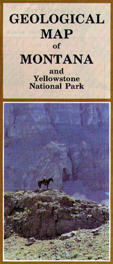
Geological Map of Montana
By Robert L. Taylor and Joseph M. Ashley |
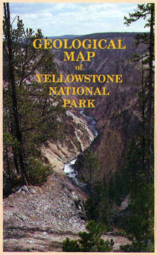
Geological Map of Yellowstone National Park
By Robert L. Taylor, Joseph M. Ashley, William W. Locke, Wayne L. Hamilton, and Jay B. Erickson
|
Geological Map of Montana
This map (18" x 24", folded) is an updated, simplified, reduced version of the 1955 Geological Map of Montana. Intended for student laboratory and classroom use, this map is the perfect automobile companion map for the interested layperson. One side includes the state Geological Map at a scale of about 1:2,000,000, the legend of mapable formations and groups and a Geologic Time Scale. The reverse shows a Tectonic Map emphasizing basement rock, volcanic rock and named structures; a map of Late Quaternary Glaciation showing ice sheets, ice caps, major mountain glaciers, and ice-dammed lakes; and a Physiographic Diagram showing named mountain Ranges and major rivers.
This map is available for $12.00 per copy. For US customers paying by credit card please follow this link . For international customers or to pay by check, please contact the MSU Department of Earth Sciences . Bulk and educational discounts also available.
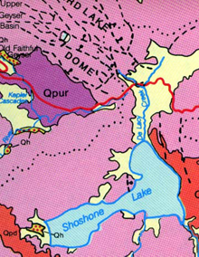
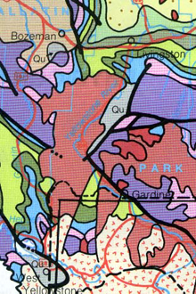 Sample cartography showing the geology of the Gallatin Valley, Paradise Valley, northern Absaroka Range, northern Yellowstone Park, and Hebgen Lake area. |
 |
Geological Map of Yellowstone National Park
This map (23" x 36", folded) includes updated, simplified, reduced versions of the USGS 1972 Geological Map and Surficial Geologic Map of Yellowstone National Park. This map was intended for general use by the interested layperson, but serves well for student field trips and other educational activities. One side includes the Geological Map at a scale of about 1:250,000, the legend of mapable formations and groups, a Geologic Time Scale, a Tectonic Map emphasizing basement rock, volcanic rock and named structures and schematic diagrams of caldera formation and eruptive volumes. The reverse shows the Surficial Geology, a satellite image, and several photographs of outstanding features. Explanatory text accompanies all maps and diagrams.
This map is available for $12.00 per copy. For U.S. customers paying by credit card please follow this link . For international customers or to pay by check, please contact the MSU Department of Earth Sciences . Bulk and educational discounts also available.
|
Sample cartography showing the road
|
Also available in Japanese |
Maps are available for $12.00 per copy. For US customers paying by credit card please follow this link. For international customers or to pay by check, please contact the MSU Department of Earth Sciences . Bulk and educational discounts also available.
Military Sites and Trading Post Maps are available for $25.00 per copy, including shipping and handling; or $45.00 for both, including shipping and handling. For US customers paying by credit card
please follow this link.
For international customers or to pay by check, please contact the
MSU Department of Earth Sciences . Bulk and educational discounts also available.